
A rather interesting map was recently donated to Missouri Valley Special Collections. It shows Kansas City area evacuation and emergency responder routes to be used in the event of nuclear attack.
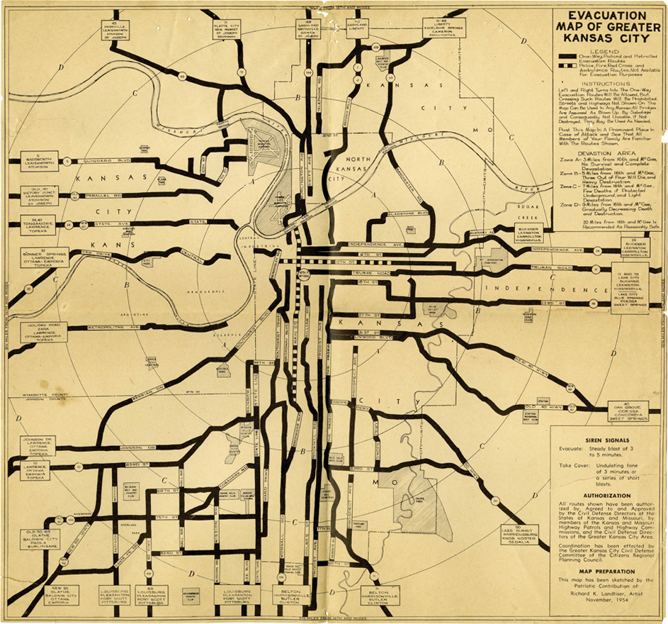
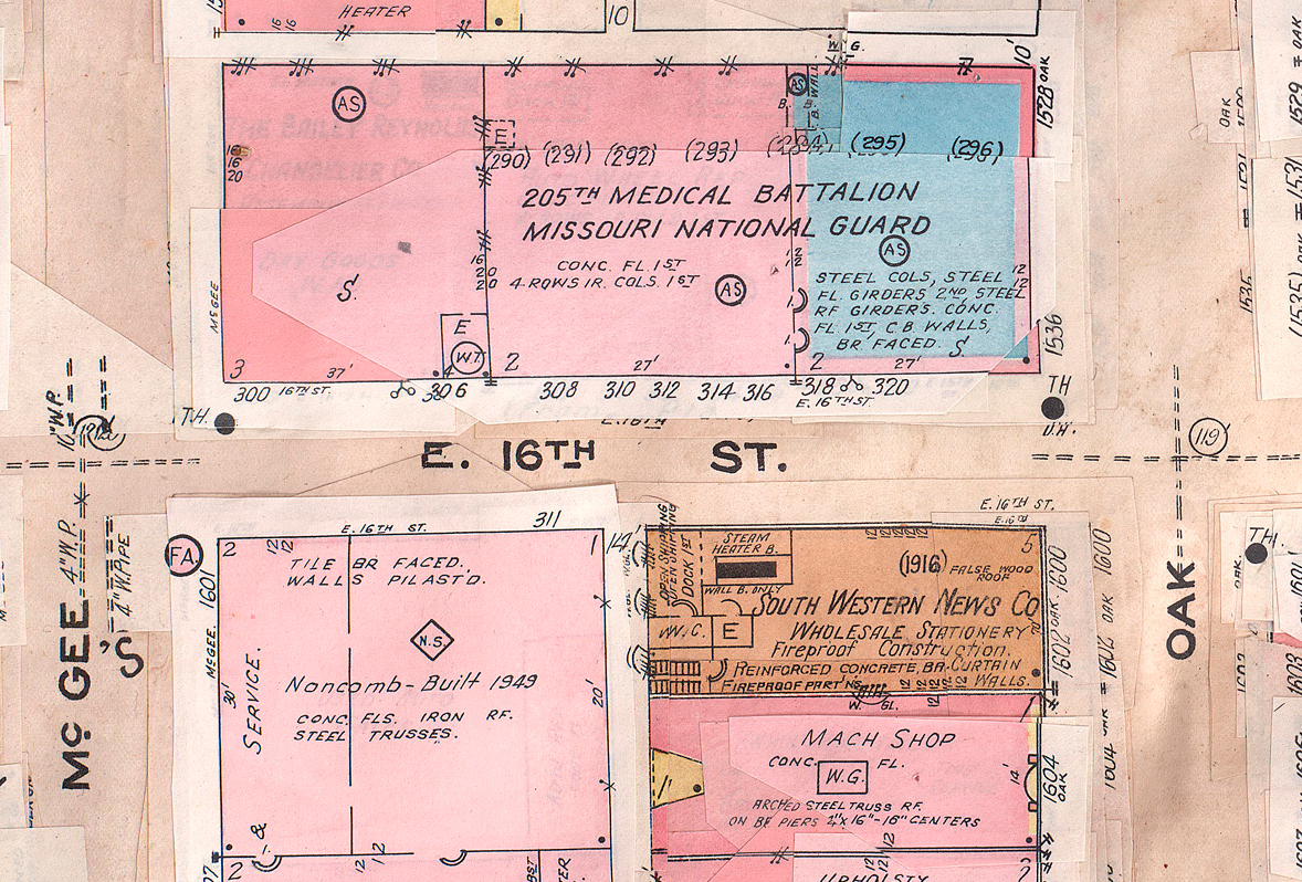
It also shows a series of concentric devastation zone circles emanating out from the intersection of 16th and McGee streets, once the headquarters of the 205th Medical Battalion of the Missouri National Guard and the likely military target in the city. It informs citizens that 20 miles from the point of impact should be considered "reasonably safe." The map truly is a unique product of its time.
By the time of the map’s creation in 1954, the United States had been involved in a Cold War against the Soviet Union and its allies for nearly a decade. The Korean War had ended the previous year, but the Soviets had also tested their first hydrogen bomb that summer. Cold War fears and anxieties in the American public manifested themselves in a variety of ways, perhaps most notably during our nation’s second Red Scare, a period where communist agents and sympathizers were thought to be lurking in every shadow. In 1950, President Harry S. Truman responded by creating the Federal Civil Defense Administration, which trickled down to the people through state and local civil defense committees.
To prepare citizens for a Soviet attack, the Civil Defense Department of Kansas City with the help of state and local committees from both sides of the state line planned an emergency evacuation and disaster response drill for November 8, 1954. Over 130,000 copies of the evacuation map were printed for the occasion. Operation Scamper, as it was known, started at 1:30 pm that Sunday afternoon with the sounding of three one-minute siren blasts to notify the nearly 2,000 participating civil defense workers and emergency response personnel across the metro that a simulated attack was imminent. Officials did not provide an estimate of how many civilians volunteered to participate in the drill, but civil defense workers and law enforcement officials halted traffic at various checkpoints along evacuation routes to distribute copies of the map and other handouts.
Civil Defense officials acknowledged at least one shortcoming of their plans, admitting that no measures to safely evacuate prison inmates and hospital patients were in place. In a lengthier phrase reminiscent of the familiar duck and cover slogan, the Greater Kansas City Area Civil Defense Committee suggested that citizens not adequately prepared in the event of an attack "lie down against the nearest wall, cover your face with your arms, and leave the rest to Providence."
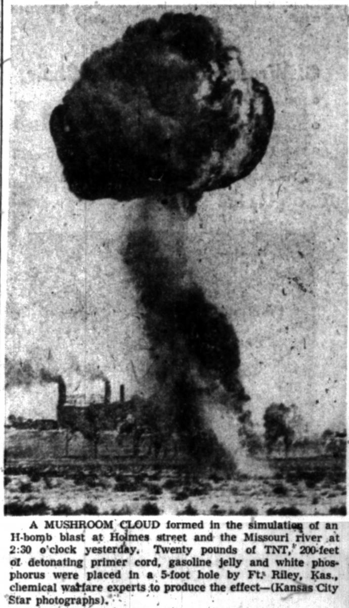
At 2:15 a final siren was sounded signaling participants to seek underground cover away from the radiation, fire, and heat that a nuclear attack would bring, and at 2:30, members of the Missouri National Guard detonated a bomb on the on the banks of the Missouri River near the ASB Bridge. A strong wind that afternoon carried the "radioactive" cloud from the explosion to the northwest, eliminating any assistance and resources that could have been counted on from North Kansas City, Leavenworth, and most of Clay and Platte counties.
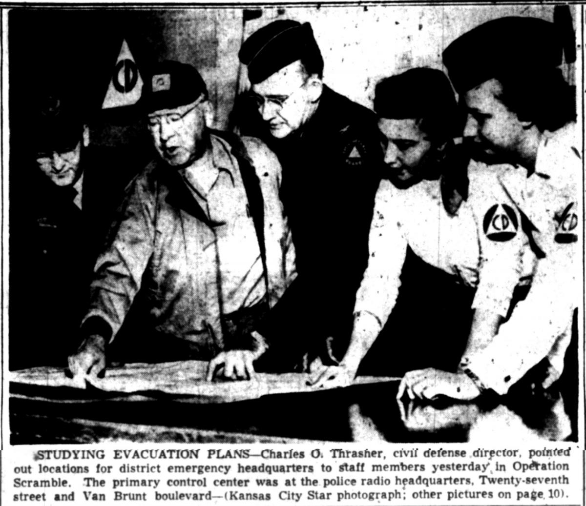
The following day Civil Defense Director Charles O. Thrasher called Operation Scamper a complete success. Kansas City was ready.
Click here to access the map.