-

-
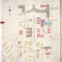
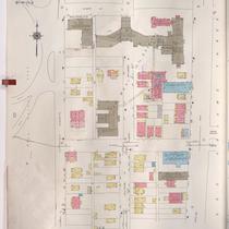
Title
-
Sanborn Map, Kansas City, Vol. 1, 1909-1938, Page p088
-
Description
-
A portion of Kansas City from W. 30th Street south to W. 31st Street and from Wyandotte east to Main, showing buildings, streets, and additions. Large numbers at edges of page refer to page with adjoining area.
-
Date
-
1909/1938
-
Object Type
-
Map
-

-
Title
-
Sanborn Map, Kansas City, Vol. 1, 1909-1938, Page p087
-
Description
-
A portion of Kansas City from W. 28th Street south to W. 29th Street and from Wyandotte east to Main Street, showing buildings, streets, and additions. Large numbers at edges of page refer to page with adjoining area.
-
Date
-
1909/1938
-
Object Type
-
Map
-
-
Title
-
Sanborn Map, Kansas City, Vol. 1A, 1939-1949, Page p155
-
Description
-
A portion of Kansas City from W. 28th Street south to W. 29th Street and from Wyandotte Street east to Main Street, showing buildings and streets. Large numbers at edges of page refer to page with adjoining area.
-
Date
-
1939/1949
-
Object Type
-
Map
-

-
Title
-
Sanborn Map, Kansas City, Vol. 1A, 1939-1949, Page p146
-
Description
-
A portion of Kansas City from W. 22nd Street south to W. 25th Street and from Broadway east to Main Street, showing buildings and streets. Large numbers at edges of page refer to page with adjoining area.
-
Date
-
1939/1949
-
Object Type
-
Map
-

-
Title
-
Sanborn Map, Kansas City, Vol. 1, 1909-1938, Page p086
-
Description
-
A portion of Kansas City from W. 26th Street south to W. 27th Street and from Central east to Main, showing buildings, streets, and additions. Large numbers at edges of page refer to page with adjoining area.
-
Date
-
1909/1938
-
Object Type
-
Map
-

-
Title
-
Sanborn Map, Kansas City, Vol. 1A, 1939-1949, Page p156
-
Description
-
A portion of Kansas City from W. 30th Street south to W. 31st Street and from Wyandotte Street east to Main Street, showing buildings and streets. Large numbers at edges of page refer to page with adjoining area.
-
Date
-
1939/1949
-
Object Type
-
Map
-

-
Title
-
Sanborn Map, Kansas City, Vol. 4, 1909-1950, Page p457
-
Description
-
A portion of Kansas City from W. 31st Street south to W. Linwood Boulevard and from Central Street east to Main Street, showing buildings, streets, and additions. Large numbers at edges of page refer to page with adjoining area.
-
Date
-
1909/1950
-
Object Type
-
Map
-

-
Title
-
Sanborn Map, Kansas City, Vol. 1, 1895-1907, Page p068
-
Description
-
Central part of early Kansas City in the Union Hill area from W. 28th Street south to W. 29th Street and from Wyandotte Street east to Main Street, showing buildings, streets, and additions. Large numbers at edges of page refer to page with adjoining area.
-
Date
-
1895/1907
-
Object Type
-
Map
-

-
Title
-
Sanborn Map, Kansas City, Vol. 1, 1895-1907, Page p070
-
Description
-
Central part of early Kansas City in Penn Valley Park and Union Hill area from about W. 29th Street south to W. 31st Street and from Central Street east to Main Street, showing buildings and streets. Large numbers at edges of page refer to page with adjoining area.
-
Date
-
1895/1907
-
Object Type
-
Map
-
-
Title
-
Sanborn Map, Kansas City, Vol. 1A, 1939-1957, Page p155
-
Description
-
A portion of Kansas City from W. 28th Street south to W. 29th Street and from Wyandotte Street east to Main Street, showing buildings and streets. Large numbers at edges of page refer to page with adjoining area.
-
Date
-
1939/1957
-
Object Type
-
Map
-

-
Title
-
Sanborn Map, Kansas City, Vol. 1, 1895-1907, Page p066
-
Description
-
Central part of early Kansas City in the Union Hill area from W. 26th Street south to W. 27th Street and from Wyandotte Street east to the edge of Union Cemetery, showing buildings, streets, and additions. Large numbers at edges of page refer to page with adjoining area.
-
Date
-
1895/1907
-
Object Type
-
Map
-

-
Title
-
Sanborn Map, Kansas City, Vol. 1A, 1939-1957, Page p156
-
Description
-
A portion of Kansas City from W. 30th Street south to W. 31st Street and from Wyandotte Street east to Main Street, showing buildings and streets. Large numbers at edges of page refer to page with adjoining area.
-
Date
-
1939/1957
-
Object Type
-
Map
