Pages
-

-
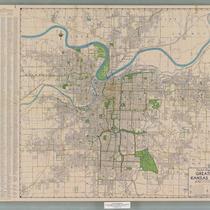
Title
-
Kansas City Metropolitan Area
-
Description
-
Plat map of the greater Kansas City area, including north Independence and southern Clay County.
-
Date
-
1927
-
Object Type
-
Map
-

-
Title
-
Kansas City Metropolitan Area
-
Description
-
Map of Kansas City area including Jackson, Cass, Clay, parts of Ray, Clinton, and Platte Counties in Missouri. Includes several counties on the Kansas side.
-
Object Type
-
Map
-

-
Title
-
Regional Map of Greater Kansas City
-
Description
-
Regional map showing major roads, highways, towns, railways, and bodies of water in Jackson, Clay, Platte, Clinton (part), and Cass (part) counties in Missouri and Johnson, Wyandotte, Leavenworth, Atchison (part), and Douglas counties in Kansas. Map also shows townships and ranges for all the areas outside the boundaries of Kansas City, Missouri and Kansas City, Kansas.
-
Date
-
1930~
-
Object Type
-
Map
-

-
Title
-
School Districts of Kansas City, Missouri
-
Description
-
Blue-line map of Kansas City, Missouri, showing boundaries for lower grade schools in the Kansas City School District. Map includes an inset showing high school boundaries. Map also shows parks, cemeteries, bodies of water, streets, boulevards, proposed parkways, railroads, and streetcar lines.
-
Date
-
1930
-
Object Type
-
Map
-
-
Title
-
Pocket Map of Greater Kansas City
-
Description
-
Road map of Kansas City and surrounding counties including Platte and Clay counties in Missouri, Wyandotte and Johnson counties in Kansas. Includes indexes to streets, public schools, and parochial schools.
-
Date
-
1950~
-
Object Type
-
Map
-

-
Title
-
Greater Kansas City
-
Description
-
Road map of Kansas City and surrounding counties including Platte and Clay counties in Missouri, Wyandotte and Johnson counties in Kansas.
-
Date
-
1957
-
Object Type
-
Map
-

-
Title
-
Gallup's Map of Greater Kansas City and Suburbs
-
Description
-
Street map of Kansas City and surrounding area including Kansas City, Kansas, and Johnson County, Kansas, Independence and North Kansas City, Missouri, and other areas. Also shows railroad lines, parks, cemeteries, etc.
-
Date
-
1925~
-
Object Type
-
Map
-

-
Title
-
Map of Cass County, MO
-
Description
-
Map of Cass County showing townships, towns, roads, creeks and streams, churches, and schools.
-
Date
-
1930~/1939~
-
Object Type
-
Map
-

-
Title
-
Urban Renewal: Kansas City, Missouri
-
Description
-
Street map of Kansas City, Missouri, showing the following urban renewal project areas: Central Business District, Columbus Park, Garfield, Woodland, 12th & Vine, Independence Plaza, Manual, Attucks, East 23rd Street, Hospital Hill, Trinity-St. Mary's, Oak Park, and Town Fork Creek. Non-federally assisted redevelopment projects, public housing areas, the freeway system, parks and boulevards, and public buildings are also indicated.
-
Date
-
1969~
-
Object Type
-
Map
-

-
Title
-
Kansas City Metropolitan Area
-
Description
-
Map of Kansas City area including Jackson, Cass, Clay, parts of Ray, Clinton, and Platte Counties in Missouri. Includes several counties on the Kansas side.
-
Date
-
1934
-
Object Type
-
Map
-

-
Title
-
Map of the Downtown Business District of Kansas City, MO
-
Description
-
Map depicting the Downtown Business District of Kansas City, Missouri, showing from 8th Street south to 14th Street, and from Broadway Boulevard east to Locust Street. Prominent buildings are labeled, including hotels, theaters, and businesses. The reverse side of the map contains a street guide of Kansas City and an advertisement for Gallup Map & Supply Co.
-
Date
-
1932
-
Object Type
-
Map
-

-
Title
-
Regional Map of Greater Kansas City
-
Description
-
Map of Kansas City Region (Leavenworth, Wyandotte, Johnson, Jackson, Cass, and Clay counties) showing numbered townships, and roads coded to indicate hard surfaced highways, graveled highways, dirt roads, proposed highways.
-
Date
-
1930
-
Object Type
-
Map
-

-
Title
-
Metropolitan Kansas City
-
Description
-
Street map of metropolitan Kansas City, with inset maps of Olathe, Kansas and Lee's Summit, Missouri. Features colored areas showing light and heavy industry, with many named industrial districts, city and school district boundaries, "switching limits."
-
Date
-
1960
-
Object Type
-
Map
-

-
Title
-
Greater Kansas City
-
Description
-
Road map of Kansas City and surrounding counties including Platte and Clay counties in Missouri, Wyandotte and Johnson counties in Kansas. Includes an index to streets.
-
Date
-
1961~
-
Object Type
-
Map
-

-
Title
-
Kansas City, Missouri School District
-
Description
-
Blue-line street map of Kansas City, Missouri, showing the boundaries of the Kansas City School District. Map also depicts public schools, parochial schools, hospitals, police stations, parks, cemeteries, golf courses, bodies of water, railroads, and significant buildings.
-
Date
-
1958
-
Object Type
-
Map
-

-
Title
-
Official Map of Greater Kansas City
-
Description
-
Map of Kansas City, Missouri, Kansas City, Kansas, and North Kansas City indicating streets, motor coach lines and street railway lines. Reverse side includes a map of U.S. highways and state highways for greater Kansas City, as well as a map of Independence and Sugar Creek showing bus lines and street railroad lines.
-
Date
-
1942
-
Object Type
-
Map
-

-
Title
-
Map of Greater Kansas City and Suburbs
-
Description
-
Street map of the greater Kansas City area, including Kansas City, Kansas, Independence, North Kansas City, and large parts of Johnson County, Kansas.
-
Date
-
1927
-
Object Type
-
Map
Pages


