-
-
Title
-
Kansas City Metropolitan Area
-
Description
-
Plat map of the greater Kansas City area, including north Independence and southern Clay County.
-
Date
-
1927
-
Object Type
-
Map
-

-
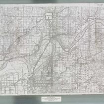
Title
-
Map of Greater Kansas City and Suburbs
-
Description
-
Street map of the greater Kansas City area, including Kansas City, Kansas, Independence, North Kansas City, and large parts of Johnson County, Kansas.
-
Date
-
1927
-
Object Type
-
Map
-
-
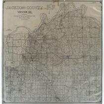
Title
-
Jackson County, Missouri
-
Description
-
Land ownership map of Jackson County, Missouri, showing roads (hard surfaced, oiled dirt, and graded), state highways, U.S. interstates, railroads (steam and electric), municipal township lines, schools, churches, streams, oil wells, gas wells, and dry holes. Includes the townships of Blue, Fort Osage, Sni A Bar, Brooking, and Washington.
-
Date
-
1927
-
Object Type
-
Map
