Pages
-

-
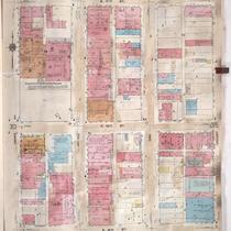
Title
-
Sanborn Map, Kansas City, Vol. 3, 1909-1957, Page p306
-
Description
-
A portion of Kansas City from Truman Road south to E. 17th Street and from Tracy Avenue east to The Paseo, showing buildings, streets, and additions. Large numbers at edges of page refer to page with adjoining area.
-
Date
-
1909/1957
-
Object Type
-
Map
-

-
Title
-
Sanborn Map, Kansas City, Vol. 5, 1909-1938, Page p617
-
Description
-
A portion of Kansas City from Norledge Avenue south to Saint John Avenue and from N. Monroe Avenue east to Clinton Place, showing buildings, streets, and additions. Large numbers at edges of page refer to page with adjoining area.
-
Date
-
1909/1938
-
Object Type
-
Map
-

-
Title
-
Sanborn Map, Kansas City, Vol. 3, 1909-1957, Page p316
-
Description
-
A portion of Kansas City from E. 17th Street south to E. 19th Street and from Charlotte east to Harrison, showing buildings, streets, and additions. Large numbers at edges of page refer to page with adjoining area.
-
Date
-
1909/1957
-
Object Type
-
Map
-

-
Title
-
Sanborn Map, Kansas City, Vol. 3, 1909-1957, Page p398
-
Description
-
A portion of Kansas City from E. 30th Street south to E. 31st Street and from Campbell Street east to Forest Avenue, showing buildings, streets, and additions. Large numbers at edges of page refer to page with adjoining area.
-
Date
-
1909/1957
-
Object Type
-
Map
-

-
Title
-
Sanborn Map, Kansas City, Vol. 3, 1909-1957, Page p302
-
Description
-
A portion of Kansas City from Truman Road south to E. 17th Street and from Grand Avenue east to Locust, showing buildings, streets, and additions. Large numbers at edges of page refer to page with adjoining area.
-
Date
-
1909/1957
-
Object Type
-
Map
-
-
Title
-
Sanborn Map, Kansas City, Vol. 3, 1909-1957, Page p314
-
Description
-
A portion of Kansas City from E. 17th Street south to E. 19th Street and from Grand Avenue east to Locust, showing buildings, streets, and additions. Large numbers at edges of page refer to page with adjoining area.
-
Date
-
1909/1957
-
Object Type
-
Map
-

-
Title
-
Sanborn Map, Kansas City, Vol. 3, 1909-1957, Page p374
-
Description
-
A portion of Kansas City from E. 27th Street south to E. 28th Street and from Campbell Street east to Forest Avenue, showing buildings, streets, and additions. Large numbers at edges of page refer to page with adjoining area.
-
Date
-
1909/1957
-
Object Type
-
Map
-

-
Title
-
Sanborn Map, Kansas City, Vol. 3, 1909-1957, Page p393
-
Description
-
A portion of Kansas City from E. 28th Street south to McGee Street Trafficway and from Oak Street east to Cherry Street, showing buildings, streets, and additions. Large numbers at edges of page refer to page with adjoining area.
-
Date
-
1909/1957
-
Object Type
-
Map
-

-
Title
-
Sanborn Map, Kansas City, Vol. 3, 1909-1957, Page p318
-
Description
-
A portion of Kansas City from E. 17th Street south to E. 19th Street and from Tracy Avenue east to The Paseo, showing buildings, streets, and additions. Large numbers at edges of page refer to page with adjoining area.
-
Date
-
1909/1957
-
Object Type
-
Map
-

-
Title
-
Sanborn Map, Kansas City, Vol. 3, 1909-1957, Page p322
-
Description
-
A portion of Kansas City from E. 17th Street south to E. 19th Street and from Olive east to Montgall Avenue, showing buildings, streets, and additions. Large numbers at edges of page refer to page with adjoining area. Formerly, the City Ice Company was in this section of town.
-
Date
-
1909/1957
-
Object Type
-
Map
-

-
Title
-
Sanborn Map, Kansas City, Vol. 3, 1909-1950, Page p312
-
Description
-
A portion of Kansas City from Truman Road south to E. 17th Street and from Bales Avenue east to Cleveland Avenue, showing buildings, streets, and additions. Large numbers at edges of page refer to page with adjoining area.
-
Date
-
1909/1950
-
Object Type
-
Map
-

-
Title
-
Sanborn Map, Kansas City, Vol. 5, 1909-1938, Page p626
-
Description
-
A portion of Kansas City from Norledge Avenue south to Saint John Avenue and from N. Bellaire Avenue east to N. Belmont Avenue, showing buildings, streets, and additions. Large numbers at edges of page refer to page with adjoining area.
-
Date
-
1909/1938
-
Object Type
-
Map
-

-
Title
-
Sanborn Map, Kansas City, Vol. 6, 1917-1957, Page p854
-
Description
-
A portion of the Intercity District between Kansas City, Missouri, and Independence, Missouri, from E. 11th Street south to E. 14th Street and from Glenwood Avenue east to Ralston Avenue, showing buildings, streets, and additions. Large numbers at edges of page refer to page with adjoining area. Noted at top of map, "Add'l Sheet, Nov. 1936. Independence."
-
Date
-
1917/1957
-
Object Type
-
Map
-

-
Title
-
Sanborn Map, Kansas City, Vol. 6, 1917-1957, Page p763
-
Description
-
A portion of northeastern Kansas City from E. 39th Street south to about E. 41st Street and from Michigan Avenue east to Brooklyn Avenue, showing buildings, streets, and additions. Large numbers at edges of page refer to page with adjoining area.
-
Date
-
1917/1957
-
Object Type
-
Map
-

-
Title
-
Sanborn Map, Kansas City, Vol. 6, 1917-1957, Page p792
-
Description
-
A portion of eastern Kansas City from E. 67th Street south to E. 69th Street and from Myrtle Avenue east to Elmwood Avenue, showing buildings, streets, and additions. Separate sections show Hillcrest Country Club, George H. Nettleton Home for Aged Ladies, Park Gate, Associated Lumber and Millwork Company, and Blue Ridge Park. Large numbers at edges of page refer to page with adjoining area.
-
Date
-
1917/1957
-
Object Type
-
Map
-

-
Title
-
Sanborn Map, Kansas City, Vol. 6, 1917-1957, Page p852
-
Description
-
A portion of Kansas City from E. 50th Street south to E. 51st Street and from Grand Avenue east to Holmes and a portion from Volker Drive south to E. 51st Street and from Rockhill Road east to Lydia Avenue, showing buildings, streets, and additions. Large numbers at edges of page refer to page with adjoining area. Noted at top of page, "Add'l Sheet Dec. 1933."
-
Date
-
1917/1957
-
Object Type
-
Map
-

-
Title
-
Sanborn Map, Kansas City, Vol. 6, 1917-1957, Page p857
-
Description
-
A portion of Sugar Creek, Missouri, from Ohio Street south to just past Independence Avenue and from S. Hardy Avenue east to Carlisle Street, showing buildings, streets, and additions. Large numbers at edges of page refer to page with adjoining area. Noted at top of map, "(708-Vol. 5) Add'l Sheet, Nov. 1939."
-
Date
-
1917/1957
-
Object Type
-
Map
-

-
Title
-
Sanborn Map, Kansas City, Vol. 6, 1917-1957, Page p836
-
Description
-
A portion of the Intercity District connecting Kansas City, Missouri, and Independence, Missouri, from Morrell Avenue south to Independence Avenue and from Blue Ridge Boulevard east to Tennessee Avenue, showing buildings, streets, and additions. Large numbers at edges of page refer to page with adjoining area.
-
Date
-
1917/1957
-
Object Type
-
Map
-

-
Title
-
Sanborn Map, Kansas City, Vol. 6, 1917-1957, Page p787
-
Description
-
A portion of eastern Kansas City from E. 55th Street south to E. 58th Street Terrace and from Walrond Avenue east to Swope Parkway, showing buildings, streets, and additions. Large numbers at edges of page refer to page with adjoining area.
-
Date
-
1917/1957
-
Object Type
-
Map
-

-
Title
-
Sanborn Map, Kansas City, Vol. 6, 1917-1957, Page p850
-
Description
-
Portions of Kansas City showing the Jackson County Hospital, Jackson County Parental Home for Negro Boys, Jackson County Home for the Aged, and Interdenominational Home for Girls, as well as some other structures. Large numbers at edges of page refer to page with adjoining area. Noted at top of page, "New Sheet Dec. 1932."
-
Date
-
1917/1957
-
Object Type
-
Map
Pages
