Perhaps you've spotted Google's Street View car cruising through Kansas City, making a photographic record of whatever it happens to pass by. It's easy to spot. In addition to the Google decal on the side of the vehicle, you can't miss the big 360-degree camera mounted on top of the roof.
Nothing escapes this camera — every home, building, vehicle, and passerby makes it into the image that serves as Google's record of that particular street — at least, until the next time they drive by several years later.
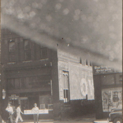
Beginning in April 1940, Kansas Citians might have spotted a similarly peculiar activity taking place throughout the city and the rest of Jackson County. Teams of two men, armed with 35mm cameras and numbered signboards, fanned out into every corner of town, taking photographs of all structures they found — from high rises to single family homes, from shacks to factories.
They were part of a larger apparatus, partially funded and staffed by the Works Progress Administration, aimed at cleaning up property records — and appearances — at the end of the Pendergast era. The Kansas City Star (February 9, 1940) lauded this “first scientific assessment,” necessary in the wake of that powerful political machine under which any reassessments, if made, were unevenly applied. The twelve teams of photographers and their sign-toting assistants were the most visible part of an organization that involved up to 600 people: local realtors, surveyors, architects, and staff to manage administrative tasks.
Not only were those two-man teams the most conspicuous parts of the project, their work comprises the bulk of what remains of it. Most of the documents from that era detailing land values, survey information, and ownership records have been lost, forgotten, or disposed of over the years. But the photographs, pasted onto cards and organized by block, survived decades in county offices, a trip to a dumpster, a rescue, and a move to City Hall.
Finally and happily, they were relocated to the Central Library and a permanent home in the Missouri Valley Room and online.
While the project's goal was to create a visual record of homes and other buildings for tax evaluation purposes (and while much current interest in the collection is focused on the pleasure of finding a 1940 photograph of your house), the 1940 Jackson County Tax Assessment Photograph Collection also provides an incomparable glimpse into daily life in Kansas City. Just as the Google Street View camera captures any person, place, or thing it happens by, so too did the WPA tax photographers.
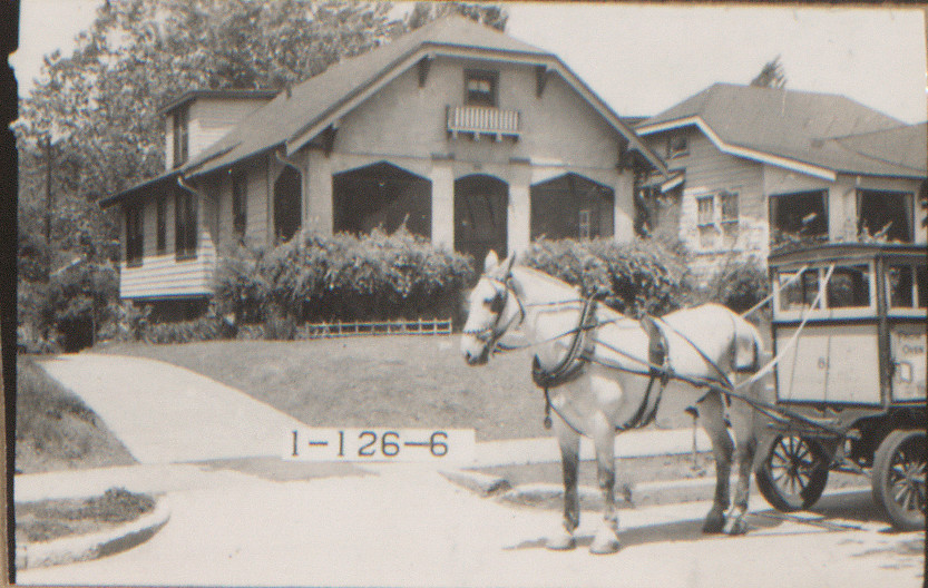
This horse and delivery cart in the South Indian Mound neighborhood was a rare sight in a bustling city where personal automobiles and streetcars were de rigueur by 1940.
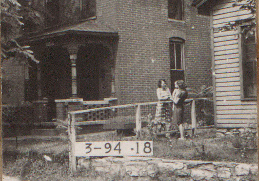
On the West Side, two ladies, one holding a toddler, visited over their shared fence as this photograph was taken. The worker in charge of the sign board has made himself scarce.
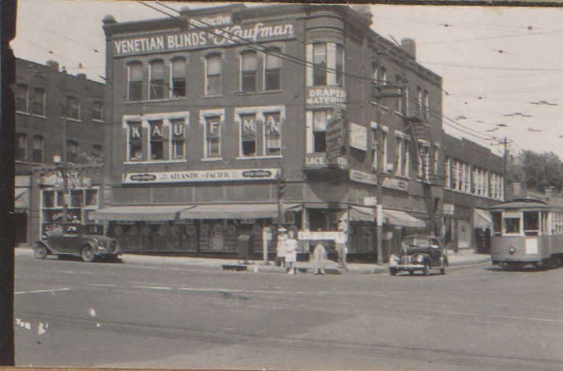
A streetcar, this one approaching the corner of 31st and Main streets, would have been a familiar sight in many Kansas City neighborhoods until they were decommissioned in the 1960s.

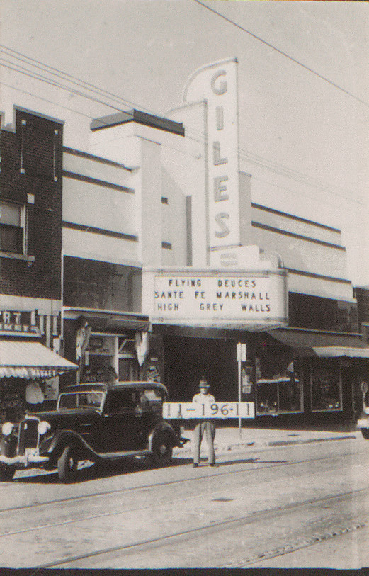
Bold movie theater marquees remind us of the entertainment venues that Kansas Citians enjoyed in 1940. The Lincoln Theater at 1330 E. 18th Street was showing Pinocchio and British Intelligence, the latter starring Boris Karloff. The Giles Theater on W. 39th Street was showing Laurel and Hardy's Flying Deuces when its photograph was taken.

In the East Bottoms neighborhood, children, including one being pushed in a toy wagon, followed the photography team down the street under the watchful eye of a woman on one house's porch.
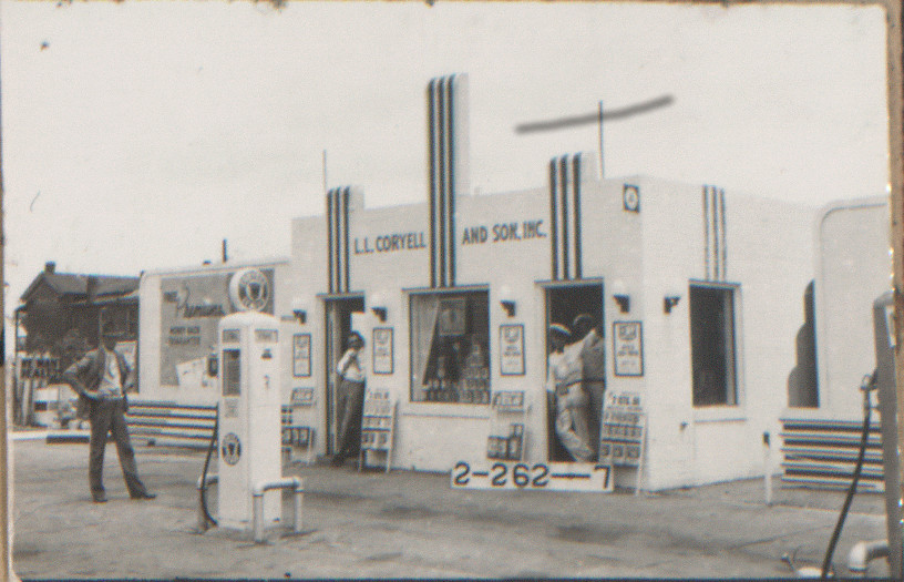
These nattily-uniformed gas station employees seem to be posing for the camera at 5th and Locust, now the site of an I-35 on-ramp.
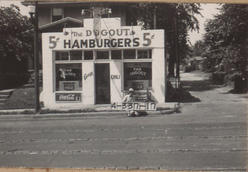
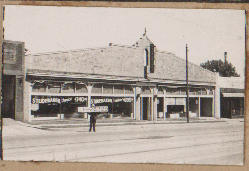
Advertisements and signs on various businesses illustrate prices for goods and services in 1940 Kansas City. Hamburgers cost five cents at The Dugout in Longfellow, and a new Studebaker Champion could be had for $740 in Westport on Broadway.
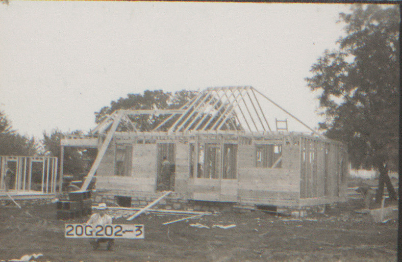
And to reaffirm that the teams photographed buildings as they were encountered, we have discovered in this collection a handful of photos of houses under construction. This worksite is in Indian Hills, which was south of the KC city limits in 1940.
The photographers even make themselves visible in the dozen or so images like this one that were blocked in part by the brim of a photographer's hat
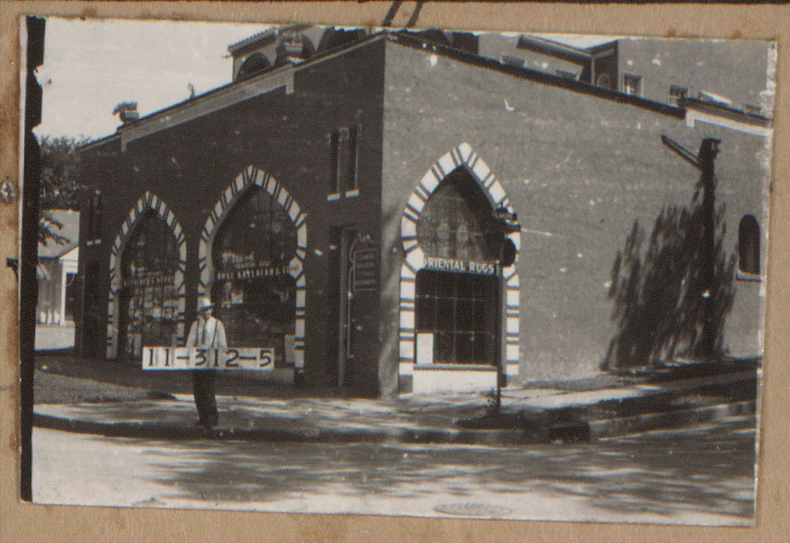
Google Street View and the 1940 Tax Assessment Photograph Collection can be used in parallel to create your own “Then and Now” moments to see how buildings and streets have evolved in the intervening decades. The Gojo Japanese Steakhouse at 4163 Broadway does not appear at first glance to be the same building that stood in that spot in 1940, but if you take a closer look, you will see that the arches on the roof remain the same, as well as outlines in the stucco on the front corner that correspond with narrow windows on the original façade of Kallaian Rose Rug Company.

(Image at left courtesy of Google)
Getting the 1940 Tax Photos online took nearly two years. The effort began with an inventory to determine the size, condition, and contents of the collection. Small repairs were necessary to many folders – primarily reattaching loose photos to their corresponding folders – and staples and old cellophane tape were removed to prevent future damage.
An outside vendor digitized each folder at high resolution, enabling their display online as well as preventing the unnecessary wear and tear to the collection that comes from physical browsing. A grant from the Institute of Museum and Library Services, under the provisions of the Library Services and Technology Act as administered by the Missouri State Library, funded the hiring of a staff member to spend a year combing through the collection. That person (the author of this blog post) identified businesses and other buildings in the photographs and determined appropriate neighborhoods, streets, and other information to attach to those records. With over 4,200 block folders containing more than 40,000 photos, there was an enormous amount of information to compile, but each additional bit makes the collection easier to search and therefore more useful to researchers.
The 1940 Collection is an invaluable resource, whether you are conducting research into Kansas City's past or simply wandering the mid-century city streets. Google's images may have made it to the Internet first, but nearly 75 years after they were taken, these photographs of everyday Kansas City are finally online, too.
