Pages
-
-
Title
-
1941 Highway Map of Jackson County, Missouri
-
Description
-
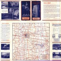
Map of county, state and United States roads in Jackson County, Missouri, including rural schools, churches and cemeteries. Legend includes conditions of roads. Regional map of Kansas City on back.
-
Date
-
1941
-
Object Type
-
Map
-

-
Title
-
1941 Highway Map of Jackson County, Missouri
-
Description
-
Map of county, state and United States roads in Jackson County, Missouri, including rural schools, churches and cemeteries. Legend includes conditions of roads. Regional map of Kansas City on back.
-
Date
-
1941
-
Object Type
-
Map
-

-
Title
-
1963 Highway Map of Jackson County, Missouri
-
Description
-
Road map of Jackson County, Missouri depicting U.S., state, and county highways. Map also shows towns, smaller roads within towns outside Kansas City city limits, parks, bodies of water, schools, churches, cemeteries, railroads, significant buildings, and a township and range grid. Verso of map contains a highway map of most of Missouri and a portion of eastern Kansas as well as color photographs of Jackson County landmarks.
-
Date
-
1963
-
Object Type
-
Map
-

-
Title
-
Clay County, Missouri
-
Description
-
Map of Clay County, Missouri including parks, highways, schools, hospitals, railroads, etc.
-
Date
-
1965
-
Object Type
-
Map
-

-
Title
-
Continental Oil Co. Official Road Map of Missouri
-
Description
-
Road map of Missouri showing the state highway system and the various type of roads within that system, as well as cities and towns according to population. Map also shows small portions of states bordering Missouri and larger portions of Illinois and Kansas. The reverse side of the map shows a small Continental Oil Co. Road Map of the United States including a key to National Parks and Monuments. Also included is a list of Continental Oil Company Service Station locations throughout the country.
-
Object Type
-
Map
-

-
Title
-
Downtown Kansas City, Missouri
-
Description
-
Map of downtown Kansas City, Missouri and vicinity showing urban renewal study area, urban renewal projects, redevelopment projects, existing and approved public housing sites, and freeway rights of way.
-
Date
-
1957
-
Object Type
-
Map
-

-
Title
-
Highway Map Missouri
-
Description
-
Road map of Missouri showing the state highway system and the various type of roads within that system, as well as cities and towns according to population. Map also shows small portions of states bordering Missouri and larger portions of Illinois and Kansas. State parks, county seats and points of interest are also identified. The reverse side of the map shows insets of Kansas City and St. Louis and a road map of the United States including National Parks and Monuments.
-
Date
-
1937
-
Object Type
-
Map
-

-
Title
-
Highway Map St. Louis and Vicinity
-
Description
-
Road map of St. Louis, Missouri showing the state highway system and the type of roads within that system, as well as golf, yacht and country clubs, points of interest, parks, airports, and rivers. Map also shows portion of Illinois bordering St. Louis. The reverse side of the map shows downtown St. Louis in greater detail featuring points of interest, parks and principal buildings. A list of what to see in St. Louis and the vicinity, along with descriptions, is also provided.
-
Date
-
1965~
-
Object Type
-
Map
-

-
Title
-
Jackson County Street Map
-
Description
-
Map of Jackson County including highways, parks, schools, and an index of streets.
-
Object Type
-
Map
-

-
Title
-
The Judge Highway Map of Kansas
-
Description
-
Kansas map showing highways. Includes list of counties and population counts for 1910, 1920, and 1930 as well as population of cities and towns.
-
Date
-
1934
-
Object Type
-
Map
-

-
Title
-
Kansas City, Missouri School District
-
Description
-
Street map of Kansas City, Missouri, including highways, railroads, streets, public schools, parochial schools, hospitals, police stations, parks, county line, city limits and state line.
-
Date
-
1958
-
Object Type
-
Map
-

-
Title
-
Kansas City Street Map
-
Description
-
Street map of metropolitan Kansas City, including Wyandotte and Johnson counties in Kansas, Gladstone, Independence, and Raytown. Indexes universities and colleges, hospitals, transportation terminals, golf courses, parks, and points of interest. Includes inset map of downtown, and a guide to radio stations.
-
Date
-
1971
-
Object Type
-
Map
-

-
Title
-
Map of Inter-City
-
Description
-
Hand-drawn map of area from proposed I-435 east to River Blvd., and from 23rd Street north to Sugar Creek. Cemeteries and parks are noted. Map appeared in the newspaper "Inter-City News" on March 22, 1968. Includes street legend.
-
Date
-
1968
-
Object Type
-
Map
-

-
Title
-
Metropolitan Kansas City
-
Description
-
Blue-line map of the metropolitan Kansas City area, specifically Cass, Jackson, Clay, and Platte Counties in Missouri, and Wyandotte, Johnson, and a portion of Leavenworth Counties in Kansas. Map depicts area municipalities and major highways, including the proposals for Interstate 635, Interstate 470, and the southeast corner of Interstate 435.
-
Date
-
1966
-
Object Type
-
Map
-

-
Title
-
Metropolitan Kansas City
-
Description
-
Map of the greater Kansas City area depicting highways, 5 mile radius circles, water mains, industrial areas, gas lines, power lines, park areas, etc.
-
Date
-
1960
-
Object Type
-
Map
-

-
Title
-
Metropolitan Kansas City: Industrial Map
-
Description
-
A map of the Kansas City metropolitan area, color-coded to indicate light industry areas, heavy industry areas, switching limits, commercial zones, and public lands. Map also shows major roads and highways, towns, bodies of water, airports, and selected railroads. Planned extensions of Interstate 435 through the west side of the metropolitan area and north of Interstates 29 and 35, of U.S. highway 71 through midtown Kansas City, of route T, and of Interstate 470 are also depicted. Map includes radial circles of five mile intervals, centered on downtown Kansas City.
-
Date
-
1970
-
Object Type
-
Map
-

-
Title
-
Missouri 1968 Official Highway Map
-
Description
-
Road map of Missouri, showing points of interest, Highway District offices, historical markers, roadside parks, rest areas, caves, forest towers. Reverse side includes a mileage chart and small maps of 45 Missouri cities, including Kansas City and St. Louis.
-
Date
-
1968
-
Object Type
-
Map
Pages

