-

-
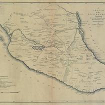
Title
-
Map of Miami County, Kansas
-
Description
-
Map of Miami County, Kansas, showing roads, townships, railroads, cemeteries, pipelines, etc.
-
Date
-
1984
-
Object Type
-
Map
-

-
Title
-
Jackson County, Missouri
-
Description
-
Color shaded map showing townships, roads, railroads, streams, schools, and churches in Jackson County, Missouri.
-
Date
-
1916
-
Object Type
-
Map
-

-
Title
-
Map of Cass County, Missouri
-
Description
-
Map of Cass County showing townships in color. Also shows rivers, roads, sections lines, schools, and railroads.
-
Date
-
1883
-
Object Type
-
Map
-

-
Title
-
Road Map of Miami County, Kansas
-
Description
-
Road map of Miami County, Kansas, showing roads, townships, railroads, cemeteries, pipelines, etc.
-
Date
-
1983
-
Object Type
-
Map
-

-
Title
-
Fabulous Johnson County, Kansas
-
Description
-
Plat map of Johnson County, Kansas, with property owner names and includes roads, railroads, townships, schools, churches, cemeteries, etc.
-
Date
-
1965
-
Object Type
-
Map
-

-
Title
-
Official Road Map of Missouri
-
Description
-
Map shows various kinds of roads in Missouri, indicating route numbers, road conditions, and points of interest. Towns, state parks, and toll bridges are also shown; reverse shows distances between various points.
-
Date
-
1931
-
Object Type
-
Map
-

-
Title
-
Map of Cass County, MO
-
Description
-
Map of Cass County showing townships, towns, roads, creeks and streams, churches, and schools.
-
Date
-
1930~/1939~
-
Object Type
-
Map
-

-
Title
-
Platte Co., Missouri
-
Description
-
Map of Platte County showing roads, railroads, towns, airports, township lines, streams, and schools. Includes list of county officials.
-
Date
-
1965~
-
Object Type
-
Map
-

-
Title
-
A New Map of Kentucky
-
Description
-
Map of Kentucky showing counties, towns, roads, and distances between towns, with insets showing the falls of Ohio, the Lexington area, and the Clarksburg area in 1846.
-
Date
-
1846
-
Object Type
-
Map
-

-
Title
-
Parker's Geological Map of the State of Missouri
-
Description
-
Title continues: "showing the location of the principal deposits of iron, lead, zinc, tin, copper, diamonds, gold, silver, platina, nickel, manganese, alabaster, kaolin, coal, oil springs, &c." Photocopy of a map of Missouri showing mineral deposits, railroads, roads, and towns. Includes tabular information giving population by county (1860 census), along with statistics of ore production.
-
Date
-
1865
-
Object Type
-
Map
-

-
Title
-
A New Map of Missouri with Its Roads and Distances
-
Description
-
Map of Missouri showing counties in color, towns, canals, roads, and railroads. At bottom of map is a list of steamboat routes. Distances between towns shown on map.
-
Date
-
1841
-
Object Type
-
Map
-

-
Title
-
Illinois and Missouri
-
Description
-
Color shaded map of Illinois and Missouri showing roads, towns, counties, forts, public houses, etc.
-
Date
-
1823
-
Object Type
-
Map
-

-
Title
-
Missouri
-
Description
-
Map of Missouri with counties shown in color. Also shows towns, roads, canals, and railroads.
-
Date
-
1855
-
Object Type
-
Map
-

-
Title
-
Highway Map of Jackson County, Missouri
-
Description
-
Road map of Jackson County, Missouri depicting U.S., state, and county highways. Map also shows towns, smaller roads within towns outside of Kansas City city limits, parks, bodies of water, schools, churches, cemeteries, railroads, significant buildings and landmarks, and township and range grid. Verso of map contains a highway map of most of Missouri and a portion of western Kansas, as well as photographs of Jackson County landmarks.
-
Date
-
1936
-
Object Type
-
Map
-

-
Title
-
Johnson's Missouri and Kansas
-
Description
-
Map of Missouri and the eastern third of Kansas, showing towns, rivers, roads, and railroads. Counties are shown in color; map is possibly a leaf from an atlas.
-
Date
-
1865
-
Object Type
-
Map
-

-
Title
-
Johnson's Missouri and Kansas
-
Description
-
Map of Missouri and the eastern third of Kansas. Counties shown in color. Shows towns, rivers, roads, and railroads. Possibly a leaf from an atlas. Illustrated with three engravings: Fire on the prairie; Santa Fe from the great Missouri Trail; and Spearing fish.
-
Date
-
1860
-
Object Type
-
Map
-

-
Title
-
Vernon County, Missouri
-
Description
-
Shows townships, towns, roads, railroads, and waterways. Map may have been taken from Hixson Plat Book of Vernon County (MVSC Q 912.778 V54h).
-
Date
-
1910~
-
Object Type
-
Map
-

-
Title
-
Wright County, Missouri
-
Description
-
Map of Wright County showing townships, towns, roads, railroads, schools, and waterways. Probably taken from Hixson's Plat Book of Wright County, Missouri.
-
Date
-
1910~
-
Object Type
-
Map