Pages
-

-
Title
-
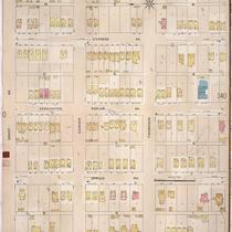
Sanborn Map, Kansas City, Vol. 2, 1896-1907, Page p141
-
Description
-
Northeastern part of early Kansas City from E. 10th Street south to E. 12th Street and from Harrison Street east to Tracy Avenue, showing buildings, streets, and additions. Large numbers at edges of page refer to page with adjoining area.
-
Date
-
1896/1907
-
Object Type
-
Map
-

-
Title
-
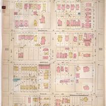
Sanborn Map, Kansas City, Vol. 3, 1896-1907, Page p257
-
Description
-
Southeastern part of early Kansas City from E. 18th Street south to E. 20th Street and from Harrison Street east to Tracy Avenue, showing buildings, streets, and additions. Large numbers at edges of page refer to page with adjoining area.
-
Date
-
1896/1907
-
Object Type
-
Map
-
-
Title
-
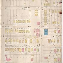
Sanborn Map, Kansas City, Vol. 3, 1896-1907, Page p339
-
Description
-
Northeastern part of early Kansas City from Smart Avenue south to Thompson Street and from Jackson Avenue east to Cypress Avenue, showing buildings, streets, and additions. Large numbers at edges of page refer to page with adjoining area.
-
Date
-
1896/1907
-
Object Type
-
Map
-

-
Title
-
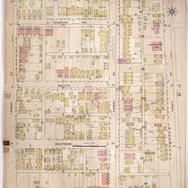
Sanborn Map, Kansas City, Vol. 3, 1896-1907, Page p271
-
Description
-
Southeastern part of early Kansas City from Matthews Avenue south to E. 23rd Street and from Agnes Avenue east to College Avenue, showing buildings, streets, and additions. Large numbers at edges of page refer to page with adjoining area.
-
Date
-
1896/1907
-
Object Type
-
Map
-
-
Title
-
Sanborn Map, Kansas City, Vol. 2, 1896-1907, Page p167
-
Description
-
Northeastern part of early Kansas City from E. 10th Street south to E. 12th Street and from Euclid Avenue east to Park Avenue, showing buildings, streets, and additions. Large numbers at edges of page refer to page with adjoining area.
-
Date
-
1896/1907
-
Object Type
-
Map
-
-
Title
-
Sanborn Map, Kansas City, Vol. 3, 1896-1907, Page p312
-
Description
-
Southeastern part of early Kansas City from E. 30th Street south to E. 31st Street and from Lydia Avenue east to Highland Avenue, showing buildings, streets, and additions. Large numbers at edges of page refer to page with adjoining area.
-
Date
-
1896/1907
-
Object Type
-
Map
-

-
Title
-
Sanborn Map, Kansas City, Vol. 2, 1896-1907, Page p122
-
Description
-
Northeast part of early Kansas City from E. 12th Street south to E. 14th Street and from Oak Street east to Holmes Street, showing buildings, streets, and additions. Large numbers at edges of page refer to page with adjoining area.
-
Date
-
1896/1907
-
Object Type
-
Map
-
-
Title
-
Sanborn Map, Kansas City, Vol. 2, 1896-1907, Page p145
-
Description
-
Northeastern part of early Kansas City from E. Missouri Avenue south to Independence Avenue and from Troost Avenue east to Tracy Avenue, showing buildings, streets, and additions. Large numbers at edges of page refer to page with adjoining area.
-
Date
-
1896/1907
-
Object Type
-
Map
-

-
Title
-
Sanborn Map, Kansas City, Vol. 2, 1896-1907, Page p161
-
Description
-
Northeastern part of early Kansas City from E. 5th Street south to Independence Avenue and from Vine Street east to Woodland Avenue, showing buildings, streets, and additions. Large numbers at edges of page refer to page with adjoining area.
-
Date
-
1896/1907
-
Object Type
-
Map
-

-
Title
-
Sanborn Map, Kansas City, Vol. 2, 1896-1907, Page p133
-
Description
-
Northeastern part of early Kansas City from Independence Avenue south to Admiral Boulevard and from Holmes Street east to Harrison Street, showing buildings, streets, and additions. Large numbers at edges of page refer to page with adjoining area.
-
Date
-
1896/1907
-
Object Type
-
Map
-

-
Title
-
Sanborn Map, Kansas City, Vol. 2, 1896-1907, Page p173
-
Description
-
Northeastern part of early Kansas City from E. 10th Street south to E. 12th Street and from Park Avenue east to Montgall Avenue, showing buildings, streets, and additions. Large numbers at edges of page refer to page with adjoining area.
-
Date
-
1896/1907
-
Object Type
-
Map
-

-
Title
-
Sanborn Map, Kansas City, Vol. 2, 1896-1907, Page p124
-
Description
-
Northeastern part of early Kansas City from E. 8th Street south to E. 10th Street and from Oak Street east to Holmes Street, showing buildings, streets, and additions. Large numbers at edges of page refer to page with adjoining area.
-
Date
-
1896/1907
-
Object Type
-
Map
-

-
Title
-
Sanborn Map, Kansas City, Vol. 2, 1896-1907, Page p217
-
Description
-
Northeastern part of early Kansas City from Nicholson Avenue south to Rochester Avenue and from Park Avenue east to Scott Avenue, showing buildings, streets, and railroad lines. Large numbers at edges of page refer to page with adjoining area.
-
Date
-
1896/1907
-
Object Type
-
Map
-

-
Title
-
Sanborn Map, Kansas City, Vol. 3, 1896-1907, Page p314
-
Description
-
Southeastern part of early Kansas City from E. 30th Street south to E. 31st Street and from Campbell Street east to Forest Avenue, as well as a section from 26th Street south to 27th Street and from Garfield Avenue east to Brooklyn Avenue, showing buildings, streets, and additions. Large numbers at edges of page refer to page with the adjoining area.
-
Date
-
1896/1907
-
Object Type
-
Map
-

-
Title
-
Sanborn Map, Kansas City, Vol. 3, 1896-1907, Page p323
-
Description
-
Southeastern part of early Kansas City from E. 31st Street south to E. 32nd Street and from Harrison Street east to Forest Avenue, showing buildings, streets, and additions. Large numbers at edges of page refer to page with the adjoining area.
-
Date
-
1896/1907
-
Object Type
-
Map
-

-
Title
-
Sanborn Map, Kansas City, Vol. 2, 1896-1907, Page p128
-
Description
-
Northeastern part of early Kansas City from E. 2nd Street south to E. 5th Street and from Oak Street east to Holmes Street, showing buildings, streets, and additions. Large numbers at edges of page refer to page with adjoining area.
-
Date
-
1896/1907
-
Object Type
-
Map
-

-
Title
-
Sanborn Map, Kansas City, Vol. 3, 1896-1907, Page p356
-
Description
-
Northern part of early Kansas City in Randolph, Missouri, showing railroad lines, buildings, and streets. Large numbers at edges of page refer to page with adjoining area. At top of map, "Randolph, Clay Co., Mo., situated 7 miles n.e. of post office."
-
Date
-
1896/1907
-
Object Type
-
Map
-

-
Title
-
Sanborn Map, Kansas City, Vol. 3, 1896-1907, Page p366
-
Description
-
Northeastern part of early Kansas City from E. 10th Street south to E. 11th Street and from Lister Avenue east to Brightwood Avenue, showing buildings, streets, and railroad lines. Portions of Scarritt Avenue and Independence Road are also shown. Large numbers at edges of page refer to page with adjoining area. At top of map, "Add'l Sheet, Dec. 1901."
-
Date
-
1896/1907
-
Object Type
-
Map
-

-
Title
-
Sanborn Map, Kansas City, Vol. 2, 1896-1907, Page p136
-
Description
-
Northeastern part of early Kansas City from E. 12th Street south to E. 14th Street and from Holmes Street east to Harrison Street, showing buildings, streets, and additions. Large numbers at edges of page refer to page with adjoining area.
-
Date
-
1896/1907
-
Object Type
-
Map
-

-
Title
-
Sanborn Map, Kansas City, Vol. 2, 1896-1907, Page p175
-
Description
-
Northeastern part of early Kansas City from Independence Boulevard south to E. 8th Street and from Park Avenue east to Prospect Avenue, showing buildings, streets, and additions. Large numbers at edges of page refer to page with adjoining area.
-
Date
-
1896/1907
-
Object Type
-
Map
Pages
