Pages
-

-
Title
-
6th Annual Goodfellowship Tour to Eureka Springs, Ark.
-
Description
-
Group portrait of participants of the South Central Business Association's 6th annual Good Fellowship Tour to Eureka Springs, Arkansas. Crescent Lake and Lake Lucerne are noted on the photograph. The group is posed in front of a Missouri Pacific Railway train in Harrisonville, Missouri.
-
Date
-
1935
-
Object Type
-
Photograph
-

-
Title
-
City of Kansas
-
Description
-
Photocopy of a cadastral map showing landowners and building outlines for the area of the City of Kansas west and north of Union Depot, comprising West Kansas Addition, Pacific Place, and Turner & Company's Addition. Companies named include S. B. Armour, Hannibal & St. Joseph Railroad, Missouri Pacific Railroad, and Morrison Packing. Key ("Explanations") at bottom of map.
-
Date
-
1886
-
Object Type
-
Map
-

-
Title
-
Sanborn Map, Kansas City, Vol. 6, 1917-1945, Page p848
-
Description
-
Portions of public park buildings and the suburb of Dodson, Missouri (later incorporated), showing buildings and streets. Large numbers at edges of page refer to page with adjoining area.
-
Date
-
1917/1945
-
Object Type
-
Map
-

-
Title
-
Sanborn Map, Kansas City, Vol. 6, 1917-1957, Page p848
-
Description
-
Portions of public park buildings and the suburb of Dodson, Missouri (later incorporated), showing buildings and streets. Large numbers at edges of page refer to page with adjoining area.
-
Date
-
1917/1957
-
Object Type
-
Map
-

-
Title
-
Sanborn Map, Kansas City, Vol. 5, 1909-1938, Page p605
-
Description
-
A portion of Kansas City from E. Front Street south to Guinotte Avenue and from N. Garfield Avenue east to N. Park Avenue, showing buildings, streets, and additions. Large numbers at edges of page refer to page with adjoining area.
-
Date
-
1909/1938
-
Object Type
-
Map
-
-
Title
-
Sanborn Map, Kansas City, Vol. 5, 1909-1938, Page p724
-
Description
-
A portion of Kansas City in the Leed's Industrial District, showing buildings, streets, and railroads. Large numbers at edges of page refer to page with adjoining area. At the top of page, "Add'l Sheet, Nov. 1928."
-
Date
-
1909/1938
-
Object Type
-
Map
-

-
Title
-
Sanborn Map, Kansas City, Vol. 5, 1909-1938, Page p706
-
Description
-
A portion of Kansas City from E. 38th Street south to E. 40th Street and from Fremont Avenue east to Bennington Avenue, showing buildings, streets, railroads, and additions. Large numbers at edges of page refer to page with adjoining area.
-
Date
-
1909/1938
-
Object Type
-
Map
-
-
Title
-
Sanborn Map, Kansas City, Vol. 5, 1909-1938, Page p690
-
Description
-
A portion of Kansas City in the Sheffield neighborhood near Crystal Avenue and the Blue River, showing buildings, streets, railroads, and additions. Large numbers at edges of page refer to page with adjoining area.
-
Date
-
1909/1938
-
Object Type
-
Map
-

-
Title
-
Sanborn Map, Kansas City, Vol. 5, 1909-1938, Page p692
-
Description
-
A portion of Kansas City from Washington Park Boulevard south to E. 7th Street and from Cambridge Avenue east to Winchester Avenue, showing buildings, streets, and additions. Large numbers at edges of page refer to page with adjoining area.
-
Date
-
1909/1938
-
Object Type
-
Map
-

-
Title
-
Sanborn Map, Kansas City, Vol. 5, 1909-1938, Page p608
-
Description
-
A portion of Kansas City from Rochester Avenue south to Guinotte Avenue and from N. Montgall Avenue east to Guinotte Avenue, showing buildings, streets, railroads, and additions. Large numbers at edges of page refer to page with adjoining area.
-
Date
-
1909/1938
-
Object Type
-
Map
-

-
Title
-
Sanborn Map, Kansas City, Vol. 5, 1909-1938, Page p607
-
Description
-
A portion of Kansas City from Rochester Avenue south to Guinotte Avenue and from N. Wabash Avenue east to N. Montgall Avenue, showing buildings, streets, railroads, and additions. Large numbers at edges of page refer to page with adjoining area.
-
Date
-
1909/1938
-
Object Type
-
Map
-

-
Title
-
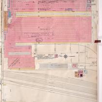
Sanborn Map, Kansas City, Vol. 5, 1909-1938, Page p707
-
Description
-
A portion of Kansas City at the intersection of E. 39th Street and Ewing Avenue, showing buildings, streets, railroads, and additions. Large numbers at edges of page refer to page with adjoining area.
-
Date
-
1909/1938
-
Object Type
-
Map
-

-
Title
-
Sanborn Map, Kansas City, Vol. 5, 1909-1938, Page p699
-
Description
-
A portion of Kansas City from E. 16th Street south to E. 17th Street and from Ewing Avenue east to Bristol Avenue, showing buildings, streets, railroads, and additions. Large numbers at edges of page refer to page with adjoining area.
-
Date
-
1909/1938
-
Object Type
-
Map
-

-
Title
-
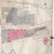
Sanborn Map, Kansas City, Vol. 5, 1909-1938, Page p722
-
Description
-
A portion of Kansas City in the Sheffield Industrial District, showing buildings, streets, and railroads. Large numbers at edges of page refer to page with adjoining area. At the top of page, "New Sheet, May 1922."
-
Date
-
1909/1938
-
Object Type
-
Map
-

-
Title
-
Sanborn Map, Kansas City, Vol. 5, 1909-1938, Page p606
-
Description
-
A portion of Kansas City from Rochester Avenue south to Guinotte Avenue and from N. Park Avenue east to N. Wabash Avenue, showing buildings, streets, railroads, and additions. Large numbers at edges of page refer to page with adjoining area.
-
Date
-
1909/1938
-
Object Type
-
Map
-

-
Title
-
Sanborn Map, Kansas City, Vol. 5, 1909-1938, Page p702
-
Description
-
A portion of Kansas City from E. 16th Street south to E. 17th Street and from Eastern Avenue east to Palmer Avenue, showing buildings, streets, railroads, and additions. Large numbers at edges of page refer to page with adjoining area.
-
Date
-
1909/1938
-
Object Type
-
Map
-

-
Title
-
Sanborn Map, Kansas City, Vol. 5, 1909-1938, Page p609
-
Description
-
A portion of Kansas City from E. Front Street south to Heim Avenue and from N. Brooklyn Avenue east to N. Olive, showing buildings, streets, railroads, and additions. Large numbers at edges of page refer to page with adjoining area.
-
Date
-
1909/1938
-
Object Type
-
Map
-

-
Title
-
Sanborn Map, Kansas City, Vol. 5, 1909-1938, Page p602
-
Description
-
A portion of Kansas City from E. Front Street south to E. 1st Street and from Lydia Avenue east to N. Vine, showing buildings, streets, railroads, and additions. Large numbers at edges of page refer to page with adjoining area.
-
Date
-
1909/1938
-
Object Type
-
Map
-

-
Title
-
Sanborn Map, Kansas City, Vol. 5, 1909-1938, Page p698
-
Description
-
A portion of Kansas City from E. 13th Street south to E. 16th Street and from Bristol Avenue east to Eastern Avenue, showing buildings, streets, railroads, and additions. Large numbers at edges of page refer to page with adjoining area.
-
Date
-
1909/1938
-
Object Type
-
Map
-

-
Title
-
Sanborn Map, Kansas City, Vol. 5, 1909-1938, Page p700
-
Description
-
A portion of Kansas City from E. 16th Street south to E. 17th Street and from Bristol Avenue east to Eastern Avenue, showing buildings, streets, railroads, and additions. Large numbers at edges of page refer to page with adjoining area.
-
Date
-
1909/1938
-
Object Type
-
Map
Pages
