Pages
-

-
Title
-
Sanborn Map, Kansas City, Vol. 6, 1917-1957, Page p780
-
Description
-
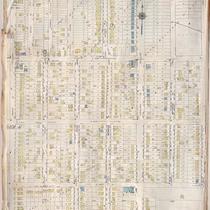
A portion of northeastern Kansas City from about E. 45th Street south to E. 47th Street and from Chestnut Avenue east to Bellefontaine Avenue, showing buildings, streets, and additions. Large numbers at edges of page refer to page with adjoining area.
-
Date
-
1917/1957
-
Object Type
-
Map
-

-
Title
-
Sanborn Map, Kansas City, Vol. 6, 1917-1957, Page p848
-
Description
-
Portions of public park buildings and the suburb of Dodson, Missouri (later incorporated), showing buildings and streets. Large numbers at edges of page refer to page with adjoining area.
-
Date
-
1917/1957
-
Object Type
-
Map
-

-
Title
-
Sanborn Map, Kansas City, Vol. 6, 1917-1957, Page p757
-
Description
-
A portion of Kansas City from E. 31st Street south to E. 33rd Street and from Walrond east to Indiana Avenue, showing buildings, streets, and additions. Large numbers at edges of page refer to page with adjoining area. Visible under paste-on correction is Menorah Hospital located at E. 50th Street and Rockhill Road.
-
Date
-
1917/1957
-
Object Type
-
Map
-

-
Title
-
Sanborn Map, Kansas City, Vol. 6, 1917-1957, Page p850
-
Description
-
Portions of Kansas City showing the Jackson County Hospital, Jackson County Parental Home for Negro Boys, Jackson County Home for the Aged, and Interdenominational Home for Girls, as well as some other structures. Large numbers at edges of page refer to page with adjoining area. Noted at top of page, "New Sheet Dec. 1932."
-
Date
-
1917/1957
-
Object Type
-
Map
-

-
Title
-
Sanborn Map, Kansas City, Vol. 6, 1917-1957, Page p755
-
Description
-
A portion of Kansas City from E. 27th Street south to Linwood Boulevard and from Lister Avenue east to Colorado Avenue, showing buildings, streets, and additions. Included are the McCune Parental Home for Boys, Hill Top School, and Jackson County Parental Home for Girls located near Independence, Missouri. Large numbers at edges of page refer to page with adjoining area. At top of page, "This sheet, except detachments, not corrected since Nov. 1939. Now shown in Vol. 5."
-
Date
-
1917/1957
-
Object Type
-
Map
-

-
Title
-
Sanborn Map, Kansas City, Vol. 6, 1917-1957, Page p788
-
Description
-
A portion of eastern Kansas City from E. 55th Street south to E. 58th Street Terrace and from Swope Parkway east to Kensington Avenue, showing buildings, streets, and additions. Large numbers at edges of page refer to page with adjoining area.
-
Date
-
1917/1957
-
Object Type
-
Map
-

-
Title
-
Sanborn Map, Kansas City, Vol. 6, 1917-1957, Page p789
-
Description
-
A portion of eastern Kansas City from E. 58th Street Terrace south to E. 62nd Street and from Walrond Avenue east to Swope Parkway, showing buildings, streets, and additions. Large numbers at edges of page refer to page with adjoining area.
-
Date
-
1917/1957
-
Object Type
-
Map
-

-
Title
-
Sanborn Map, Kansas City, Vol. 6, 1917-1957, Page p847
-
Description
-
A portion of the Kansas City Municipal Farm and House of Corrections, located 1.5 miles southeast of Leeds, Missouri, showing buildings and streets. Large numbers at edges of page refer to page with adjoining area.
-
Date
-
1917/1957
-
Object Type
-
Map
-

-
Title
-
Sanborn Map, Kansas City, Vol. 6, 1917-1957, Page p833
-
Description
-
Index to New Report of Intercity District showing area connecting Kansas City, Missouri, and Independence, Missouri, as well as Sugar Creek district, dated December 1932. At bottom of sheet is a portion of Sugar Creek from Scarritt Avenue south to Kentucky Avenue and from Home Avenue east to Ralston Avenue, showing buildings, streets, and additions. Large numbers at edges of page refer to page with adjoining area. A new report for Sugar Creek is also attached dated November 1939.
-
Date
-
1917/1957
-
Object Type
-
Map
-

-
Title
-
Sanborn Map, Kansas City, Vol. 6, 1917-1957, Page p792
-
Description
-
A portion of eastern Kansas City from E. 67th Street south to E. 69th Street and from Myrtle Avenue east to Elmwood Avenue, showing buildings, streets, and additions. Separate sections show Hillcrest Country Club, George H. Nettleton Home for Aged Ladies, Park Gate, Associated Lumber and Millwork Company, and Blue Ridge Park. Large numbers at edges of page refer to page with adjoining area.
-
Date
-
1917/1957
-
Object Type
-
Map
-

-
Title
-
Sanborn Map, Kansas City, Vol. 6, 1917-1957, Page p855
-
Description
-
A portion of the Intercity District between Kansas City, Missouri, and Independence, Missouri, from E. 14th Street south to E. 18th Street and from Arlington Avenue east to Maywood Avenue, showing buildings, streets, and additions. Large numbers at edges of page refer to page with adjoining area. Noted at top of map, "Add'l Sheet, Nov. 1936. Independence."
-
Date
-
1917/1957
-
Object Type
-
Map
-
-
Title
-
Sanborn Map, Kansas City, Vol. 6, 1917-1957, Page p751
-
Description
-
A portion of Kansas City from E. 42nd Street south to E. 45th Street and from Indiana Avenue east to Myrtle Avenue, showing buildings, streets, and additions. Large numbers at edges of page refer to page with adjoining area. Update at top of page reads "(758) 'NA' May 1945."
-
Date
-
1917/1957
-
Object Type
-
Map
-

-
Title
-
Sanborn Map, Kansas City, Vol. 6, 1917-1957, Page p854
-
Description
-
A portion of the Intercity District between Kansas City, Missouri, and Independence, Missouri, from E. 11th Street south to E. 14th Street and from Glenwood Avenue east to Ralston Avenue, showing buildings, streets, and additions. Large numbers at edges of page refer to page with adjoining area. Noted at top of map, "Add'l Sheet, Nov. 1936. Independence."
-
Date
-
1917/1957
-
Object Type
-
Map
-

-
Title
-
Sanborn Map, Kansas City, Vol. 6, 1917-1957, Page p840
-
Description
-
A portion of Kansas City from Independence Avenue south to E. 11th Street and from Overton Avenue east to S. Hardy Avenue, showing buildings, streets, and additions. Large numbers at edges of page refer to page with adjoining area.
-
Date
-
1917/1957
-
Object Type
-
Map
-

-
Title
-
Sanborn Map, Kansas City, Vol. 6, 1917-1957, Page p838
-
Description
-
A portion of the Intercity District connecting Kansas City, Missouri, and Independence, Missouri, from Morrell Avenue south to Independence Avenue and from Overton Avenue east to Hardy Avenue, showing buildings, streets, and additions. Large numbers at edges of page refer to page with adjoining area.
-
Date
-
1917/1957
-
Object Type
-
Map
-
-
Title
-
Sanborn Map, Kansas City, Vol. 6, 1917-1957, Page p793
-
Description
-
A portion of western Kansas City from W. 46th Street south to W. 48th Street and from State Line Road east to Fairmount Avenue, showing buildings, streets, and additions. Large numbers at edges of page refer to page with adjoining area.
-
Date
-
1917/1957
-
Object Type
-
Map
-

-
Title
-
Sanborn Map, Kansas City, Vol. 6, 1917-1957, Page p825
-
Description
-
A portion of Kansas City from W. 54th Street south to W. 57th Street and from State Line Road east to Belleview Avenue, showing buildings, streets, and additions. Large numbers at edges of page refer to page with adjoining area.
-
Date
-
1917/1957
-
Object Type
-
Map
-

-
Title
-
Sanborn Map, Kansas City, Vol. 6, 1917-1957, Page p800
-
Description
-
A portion of western Kansas City from W. 51st Street south to W. 54th Street and from State Line Road east to Belleview Avenue, showing buildings, streets, and additions. Large numbers at edges of page refer to page with adjoining area.
-
Date
-
1917/1957
-
Object Type
-
Map
-

-
Title
-
Sanborn Map, Kansas City, Vol. 6, 1917-1957, Page p826
-
Description
-
A portion of Kansas City from W. 57th Street south to W. 59th Street Terrace and from State Line Road east to Belleview Avenue, showing buildings, streets, and additions. Large numbers at edges of page refer to page with adjoining area.
-
Date
-
1917/1957
-
Object Type
-
Map
-

-
Title
-
Sanborn Map, Kansas City, Vol. 6, 1917-1957, Page f004
-
Description
-
Key to Sanborn Map of Kansas City, Vol. 6, 1917-1957, showing Kansas City area bounded from E. 31st Street to the north, 71st Street to the south, Elmwood to the east, and the State line to the west. Also shows railroads, bridges, and a graphic map of other volumes.
-
Date
-
1917/1957
-
Object Type
-
Map
Pages
