-

-
Title
-
Sanborn Map, Kansas City, Vol. 3, 1909-1957, Page p368
-
Description
-
A portion of Kansas City from E. 26th Street south to E. 28th Street and from Main Street east to McGee Street, showing buildings, streets, and additions. Large numbers at edges of page refer to page with adjoining area.
-
Date
-
1909/1957
-
Object Type
-
Map
-

-
Title
-
Sanborn Map, Kansas City, Vol. 3, 1909-1957, Page p314
-
Description
-
A portion of Kansas City from E. 17th Street south to E. 19th Street and from Grand Avenue east to Locust, showing buildings, streets, and additions. Large numbers at edges of page refer to page with adjoining area.
-
Date
-
1909/1957
-
Object Type
-
Map
-

-
Title
-
Sanborn Map, Kansas City, Vol. 6, 1917-1957, Page p838
-
Description
-
A portion of the Intercity District connecting Kansas City, Missouri, and Independence, Missouri, from Morrell Avenue south to Independence Avenue and from Overton Avenue east to Hardy Avenue, showing buildings, streets, and additions. Large numbers at edges of page refer to page with adjoining area.
-
Date
-
1917/1957
-
Object Type
-
Map
-

-
Title
-
Sanborn Map, Kansas City, Vol. 6, 1917-1957, Page p859
-
Description
-
A portion of Leeds, Missouri, from E. 37th Street south to E. 40th Street and from Belmont Avenue east to Bennington Avenue, showing buildings, streets, and additions. Large numbers at edges of page refer to page with adjoining area. Noted at top of map, "(705-706-722-Vol. 5) Add'l Sheet, Nov. 1939."
-
Date
-
1917/1957
-
Object Type
-
Map
-

-
Title
-
Sanborn Map, Kansas City, Vol. 1A, 1939-1949, Page p117
-
Description
-
A portion of Kansas City from W. 15th Street south to W. 16th Street and from Broadway east to Main Street, showing buildings and streets. Large numbers at edges of page refer to page with adjoining area.
-
Date
-
1939/1949
-
Object Type
-
Map
-
-
Title
-
Sanborn Map, Kansas City, Vol. 1A, 1939-1949, Page p148
-
Description
-
A portion of Kansas City from W. 25th Street south to W. 26th Street and from Madison Avenue east to W. Pennway, showing buildings and streets. Large numbers at edges of page refer to page with adjoining area.
-
Date
-
1939/1949
-
Object Type
-
Map
-

-
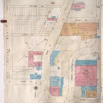
Title
-
Sanborn Map, Kansas City, Vol. 3, 1909-1957, Page p311
-
Description
-
A portion of Kansas City from Truman Road south to E. 17th Street and from Walrond Avenue east to Indiana Avenue, showing buildings, streets, railroads and additions. Large numbers at edges of page refer to page with adjoining area.
-
Date
-
1909/1957
-
Object Type
-
Map
-

-
Title
-
Sanborn Map, Kansas City, Vol. 3, 1909-1957, Page p371
-
Description
-
A portion of Kansas City from E. 25th Street south to E. 26th Street and from Gillham Road east to Campbell Street, showing buildings, streets, and additions. Large numbers at edges of page refer to page with adjoining area.
-
Date
-
1909/1957
-
Object Type
-
Map
-
-
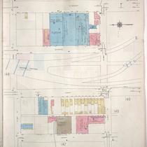
Title
-
Sanborn Map, Kansas City, Vol. 3, 1909-1957, Page p367
-
Description
-
A portion of Kansas City from City View Avenue south to E. 26th Street and from Main Street east to McGee Street, showing buildings, streets, and additions. Large numbers at edges of page refer to page with adjoining area.
-
Date
-
1909/1957
-
Object Type
-
Map
-
-
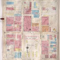
Title
-
Sanborn Map, Kansas City, Vol. 3, 1909-1957, Page p315
-
Description
-
A portion of Kansas City from E. 17th Street south to E. 19th Street and from Locust east to Charlotte, showing buildings, streets, and additions. Large numbers at edges of page refer to page with adjoining area.
-
Date
-
1909/1957
-
Object Type
-
Map
-

-
Title
-
Sanborn Map, Kansas City, Vol. 1A, 1939-1949, Page p118
-
Description
-
A portion of Kansas City from W. 21st Street south to W. 22nd Street and from Braoadway east to Wyandotte, showing buildings and streets. Large numbers at edges of page refer to page with adjoining area.
-
Date
-
1939/1949
-
Object Type
-
Map
-
-
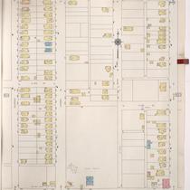
Title
-
Sanborn Map, Kansas City, Vol. 5, 1940-1941, Page p0602
-
Description
-
A portion of Kansas City from just north of E. 14th Street south to E. 15th Street and from Colorado Avenue east to Oakley Avenue, showing buildings and streets. Large numbers at edges of page refer to page with adjoining area. Indicated at top of sheet that this page number corresponds with page 658 in Vol. 5, 1909-1938.
-
Date
-
1940/1941
-
Object Type
-
Map
-

-
Title
-
Kansas City's Wheel Man Has Fatal Heart Attack
-
Description
-
Greg Weld, a Kansas City-born driver and auto-racing entrepreneur, died August 4, 2008, at the age of 64. He started his career as a race driver beginning in the U.S. Auto Club sprint cars series in the 1960s. He won 21 USAC races and was the sprint car champion in 1967. "He also drove in the Champ Car series, which was sanctioned by USAC at the time, in the 1960s and '70s. He made one start in the Indianapolis 500, qualifying 28th and finishing 32nd in 1970." In 1967 he founded Weld Wheel Industries, a company that produced racing wheels "that became the industry's gold standard." Includes his picture.
-
Date
-
2008-08-05
-
Object Type
-
Newspaper Article
