-
-
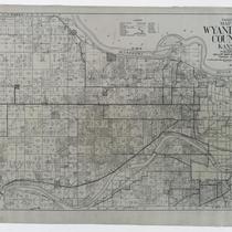
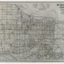
Title
-
Gallup's Map of Wyandotte County, Kansas
-
Description
-
Land ownership map of Wyandotte County, Kansas, showing county roads, roads, railroads, electric railroads, schools, churches, cemeteries, streams, and township boundaries, as well as drilling, oil, gas, dry, and abandoned wells. Includes the townships of Prairie, Quindaro, Wyandotte, Delaware, and Shawnee.
-
Date
-
1923
-
Object Type
-
Map
-
![Map of Cass County, Mo. [Southern Section]](https://kchistory.org/sites/default/files/styles/islandora_imagecache_image_style_medium/public/externals/0f24d14bdc37d350cece388889339b08.jpg?itok=8FOOtRg_&pid=kchistory:106281&iic=true&solr_nav%5Bid%5D=eb4ad0811ad5f7df1ac2&solr_nav%5Bpage%5D=0&solr_nav%5Boffset%5D=1)
-
Title
-
Map of Cass County, Mo. [Southern Section]
-
Description
-
Land ownership map of Cass County, Missouri, showing paved and graveled roads, schools and school district boundaries, railroads, section lines, twp.& range lines, streams, cemeteries, houses, and churches. Includes the southern Cass County townships of West Dolan, Dolan, Grand River, Camp Branch, Index, Cold Water, Everett, Austin, Dayton, and Sherman.
-
Object Type
-
Map
-
![Map of Cass County, Mo. [Northern Section]](https://kchistory.org/sites/default/files/styles/islandora_imagecache_image_style_medium/public/externals/babbf0d2e9bc527adc02442ccdcf7e70.jpg?itok=MnApPT7k&pid=kchistory:106282&iic=true&solr_nav%5Bid%5D=eb4ad0811ad5f7df1ac2&solr_nav%5Bpage%5D=0&solr_nav%5Boffset%5D=2)
-
Title
-
Map of Cass County, Mo. [Northern Section]
-
Description
-
Land ownership map of Cass County, Missouri, showing paved and graveled roads, schools and school district boundaries, railroads, section lines, twp.& range lines, streams, cemeteries, houses, and churches. Includes the northern Cass County townships of Mount Pleasant, Raymore, Big Creek, Pleasant Hill, Polk, Union, West Peculiar and Peculiar.
-
Object Type
-
Map
-
-
Title
-
Johnson County, Kansas
-
Description
-
Land ownership map of Johnson County, Kansas, showing U.S highways, state highways, railroads, roads (paved, gravel and graded) political township boundaries, civil township lines, schools, churches, cemeteries, rivers, and streams. Includes the townships of Lexington, Monticello, Shawnee, Mission, Olathe, Oxford, McCamish, Gardner, Spring Hill, and Aubry.
-
Date
-
1930~
-
Object Type
-
Map
-
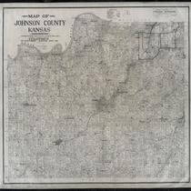
-
Title
-
Map of Johnson County, Kansas
-
Description
-
Land ownership map of Johnson County, Kansas, showing railroads, electric lines, public roads, rock roads, school districts, streams, churches, and cemeteries, as well as oil, gas, drilling, dry, and abandoned wells. Includes the townships of Lexington, Monticello, Shawnee, Mission, Olathe, Oxford, McCamish, Gardner, Spring Hill, and Aubry. The names "checked by Frank Norman, bonded abstractor, Olathe, Kansas."
-
Date
-
1912
-
Object Type
-
Map
-
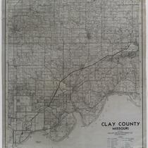
-
Title
-
Clay County, Missouri
-
Description
-
Land ownership map of Clay County, Missouri, showing U.S. highways, state and county roads, paved, graveled and graded roads, railroads, abandoned railroads, political township boundaries, twp. & range lines, future city limits, schools, churches, rivers and streams. Includes the townships of Kearney, Washington, Platte, Liberty, Gallatin, and Fishing River.
-
Date
-
1955~
-
Object Type
-
Map
-
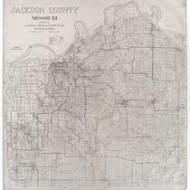
![Map of Jackson County, Missouri [Southern Section]](https://kchistory.org/sites/default/files/styles/islandora_imagecache_image_style_medium/public/externals/e29099cb1563d7af72b6972249d0e6f0.jpg?itok=ZS44X5kY&pid=kchistory:106275&iic=true&solr_nav%5Bid%5D=eb4ad0811ad5f7df1ac2&solr_nav%5Bpage%5D=0&solr_nav%5Boffset%5D=6)
-
Title
-
Map of Jackson County, Missouri [Southern Section]
-
Description
-
Land ownership map of the southern part of Jackson County, Missouri, showing railroads, electric railroads, highways (macadamized, graded, main), rural mail routes, streams, churches, school houses, and cemeteries. Includes the townships of Westport, Brooking, Washington, Prairie, and Van Buren, as well as the cities of Blue Springs, Martin City, and Grandview. The map draftsmen are identified as Jas. H. Southwell, A. H. Doty, and A. W. Hirsh.
-
Date
-
1909~
-
Object Type
-
Map
-
![Map of Jackson County, Missouri [Northern Section]](https://kchistory.org/sites/default/files/styles/islandora_imagecache_image_style_medium/public/externals/b47d5f41554cee2dc6d9768748e4acef.jpg?itok=O6FpK5xJ&pid=kchistory:106276&iic=true&solr_nav%5Bid%5D=eb4ad0811ad5f7df1ac2&solr_nav%5Bpage%5D=0&solr_nav%5Boffset%5D=7)
-
Title
-
Map of Jackson County, Missouri [Northern Section]
-
Description
-
Land ownership map of the northern part of Jackson County, Missouri, showing railroads, electric railroads, highways (macadamized, graded, main), rural mail routes, streams, churches, school houses, and cemeteries. Includes the townships of Kaw, Fort Osage, and Sni A Bar, as well as the cities of Kansas City and Independence. The map draftsmen are identified as Jas. H. Southwell, A. H. Doty, and A. W. Hirsh.
-
Date
-
1909~
-
Object Type
-
Map
-

-
Title
-
Buchanan County, Missouri
-
Description
-
Land ownership map of Buchanan County, Missouri, showing highways, paved and graveled roads, civil and political TWP lines, railroads, schools, churches, cemeteries, and streams. Includes the townships of Washington, Marion, Wayne, Center, Agency, Tremont, Rush, Bloomington, Crawford, Jackson, and Platte.
-
Date
-
1940~
-
Object Type
-
Map
-

-
Title
-
New Map of Jackson County, Missouri
-
Description
-
Land ownership map of Jackson County, Missouri, showing roads (hard surfaced, oiled dirt, and graded), state highways, U.S. interstates, railroads (steam and electric), municipal township lines, schools, churches, streams, oil wells, gas wells, and dry holes. Includes the townships of Blue, Fort Osage, Sni A Bar, Brooking, and Washington.
-
Date
-
1930~
-
Object Type
-
Map
-
-
Title
-
Jackson County, Missouri
-
Description
-
Land ownership map of Jackson County, Missouri, showing roads (hard surfaced, oiled dirt, and graded), state highways, U.S. interstates, railroads (steam and electric), municipal township lines, schools, churches, streams, oil wells, gas wells, and dry holes. Includes the townships of Blue, Fort Osage, Sni A Bar, Brooking, and Washington.
-
Date
-
1927
-
Object Type
-
Map
-
-
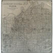
Title
-
Jackson County, Missouri
-
Description
-
Land ownership map of Jackson County, Missouri, showing railroads (steam and electric), roads (rock, oiled, graded), schools, churches, streams, oil wells, gas wells, and dry holes. Includes townships of Blue, Fort Osage, Sni A Bar, Brooking, and Washington.
-
Date
-
1920~
-
Object Type
-
Map
-

-
Title
-
Map of Wyandotte Co., Kansas
-
Description
-
Land ownership map of Wyandotte County, Kansas, showing roads, railroads, electric railroads, schools, churches, cemeteries, streams, and township boundary lines. Includes the townships of Prairie, Quindaro, Wyandotte, Delaware, and Shawnee.
-
Date
-
1920~
-
Object Type
-
Map
-
-
Title
-
Wyandotte County, Kansas
-
Description
-
Land ownership map of Wyandotte County, Kansas, showing U.S. and state highways, roads (paved, gravel, and graded), railroads, electric lines, state lines, county lines, city limits, sub. division boundaries, political township boundaries, civil township lines, school and district numbers, churches, cemeteries, streams and rivers, as well as the drainage district boundaries for East Loring, Kaw Valley, and Fairfax. Includes the townships of Prairie, Quindaro, Wyandotte, Delaware, and Shawnee.
-
Date
-
1940~
-
Object Type
-
Map
-

-
Title
-
Gallup's Map of Wyandotte County, Kansas
-
Description
-
Land ownership map of Wyandotte County, Kansas, showing U.S. and state highways, roads (paved, gravel, and graded), railroads, electric lines, state lines, county lines, city limits, sub. division boundaries, political township boundaries, civil township lines, school and district numbers, churches, cemeteries, streams and rivers, as well as the drainage district boundaries for East Loring, Kaw Valley, and Fairfax. Includes the townships of Prairie, Quindaro, Wyandotte, Delaware, and Shawnee.
-
Date
-
1939
-
Object Type
-
Map
-

-
Title
-
The Berry Company's Map of Kansas City, Kansas
-
Description
-
Land ownership map of the city of Kansas City, Kansas, showing steam and electric railways, parks, schools, cemeteries, businesses, and municipal buildings and landmarks.
-
Date
-
1910~
-
Object Type
-
Map
