-

-
Title
-
Geologic Cross Sections of Kansas City and Jackson County
-
Description
-
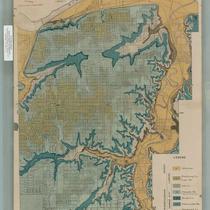
Six cross sections of areas of Jackson County, Missouri, and Kansas City, Missouri, illustrate altitude above sea level and types of bedrock. Labels display locations of creeks and rivers, as well as major city thoroughfares including Southwest Boulevard, Armour Boulevard, and 75th Street.
-
Object Type
-
Map
-

-
Title
-
Town of Kansas Plat
-
Description
-
Photograph of the original plat map for the the Town of Kansas.
-
Date
-
1839
-
Object Type
-
Photograph
-

-
Title
-
Map of the City of Kansas - Jackson County, Missouri
-
Description
-
Map of the City of Kansas, later known as Kansas City, in Jackson County, Missouri. Major streets, railroad lines, additions and subdivisions are marked. Landmarks and significant buildings are labeled. Harlem on the north side of the Missouri River in Clay County, Missouri, is shown.
-
Date
-
1880
-
Object Type
-
Map
-

-
Title
-
Geological Map of Jackson County, Missouri
-
Description
-
Map detailing geological features of Kansas City. Different colors are used to show geological features and a street map is superimposed over the geological information.
-
Date
-
1917
-
Object Type
-
Map
-

-
Title
-
Geological Map of Kansas City, Missouri
-
Description
-
Map detailing geological features of Kansas City. Different colors are used to show geological features and a street map is superimposed over the geological information.
-
Date
-
1917
-
Object Type
-
Map
-

-
Title
-
Clay County, Missouri
-
Description
-
Land ownership map of Clay County, Missouri, showing U.S. highways, state and county roads, paved, graveled and graded roads, railroads, abandoned railroads, political township boundaries, twp. & range lines, future city limits, schools, churches, rivers and streams. Includes the townships of Kearney, Washington, Platte, Liberty, Gallatin, and Fishing River.
-
Date
-
1955~
-
Object Type
-
Map