-

-
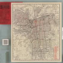
Title
-
Kansas City Metropolitan Area
-
Description
-
Plat map of the greater Kansas City area, including north Independence and southern Clay County.
-
Date
-
1927
-
Object Type
-
Map
-

-
Title
-
School Districts of Kansas City, Missouri
-
Description
-
Blue-line map of Kansas City, Missouri, showing boundaries for lower grade schools in the Kansas City School District. Map includes an inset showing high school boundaries. Map also shows parks, cemeteries, bodies of water, streets, boulevards, proposed parkways, railroads, and streetcar lines.
-
Date
-
1930
-
Object Type
-
Map
-

-
Title
-
Pocket Map of Greater Kansas City
-
Description
-
Road map of Kansas City and surrounding counties including Platte and Clay counties in Missouri, Wyandotte and Johnson counties in Kansas. Includes indexes to streets, public schools, and parochial schools.
-
Date
-
1950~
-
Object Type
-
Map
-

-
Title
-
Greater Kansas City
-
Description
-
Road map of Kansas City and surrounding counties including Platte and Clay counties in Missouri, Wyandotte and Johnson counties in Kansas.
-
Date
-
1957
-
Object Type
-
Map
-

-
Title
-
Metropolitan Kansas City
-
Description
-
Street map of metropolitan Kansas City, with inset maps of Olathe, Kansas and Lee's Summit, Missouri. Features colored areas showing light and heavy industry, with many named industrial districts, city and school district boundaries, "switching limits."
-
Date
-
1960
-
Object Type
-
Map
-

-
Title
-
Greater Kansas City
-
Description
-
Road map of Kansas City and surrounding counties including Platte and Clay counties in Missouri, Wyandotte and Johnson counties in Kansas. Includes an index to streets.
-
Date
-
1961~
-
Object Type
-
Map
-

-
Title
-
Kansas City, Missouri School District
-
Description
-
Blue-line street map of Kansas City, Missouri, showing the boundaries of the Kansas City School District. Map also depicts public schools, parochial schools, hospitals, police stations, parks, cemeteries, golf courses, bodies of water, railroads, and significant buildings.
-
Date
-
1958
-
Object Type
-
Map
-
-
Title
-
Official Map of Greater Kansas City
-
Description
-
Map of Kansas City, Missouri, Kansas City, Kansas, and North Kansas City indicating streets, motor coach lines and street railway lines. Reverse side includes a map of U.S. highways and state highways for greater Kansas City, as well as a map of Independence and Sugar Creek showing bus lines and street railroad lines.
-
Date
-
1942
-
Object Type
-
Map


