-

-
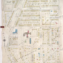
Title
-
Sanborn Map, Kansas City, Vol. 9, 1930-1957, Page p1020
-
Description
-
A portion of Kansas City from E. 63rd Street south to E. 66th Street Terrace and from Oak Street east to Rockhill Road, showing buildings, streets, and additions. Large numbers at edges of page refer to page with adjoining area. At top of map, "Add'l Sheet, June 1939."
-
Date
-
1930/1957
-
Object Type
-
Map
-

-
Title
-
Sanborn Map, Kansas City, Vol. 9, 1930-1957, Page p1120
-
Description
-
A portion of Kansas City from E. 72nd Street south to E. 74th Street and from Olive Street east to Montgall Avenue, showing buildings, streets, and additions. Large numbers at edges of page refer to page with adjoining area.
-
Date
-
1930/1957
-
Object Type
-
Map
-

-
Title
-
Sanborn Map, Kansas City, Vol. 9, 1930-1957, Page p0929
-
Description
-
A portion of Kansas City from E. 58th Street south to E. 59th Street and from Lydia Avenue east to Highland Avenue, showing buildings, streets, and additions. Large numbers at edges of page refer to page with adjoining area.
-
Date
-
1930/1957
-
Object Type
-
Map
-

-
Title
-
Sanborn Map, Kansas City, Vol. 9, 1930-1957, Page p1030
-
Description
-
A portion of Kansas City from E. 63rd Street south to E. 65th Street and from Rockhill Road east to Troost Avenue, showing buildings, streets, and additions. Large numbers at edges of page refer to page with adjoining area.
-
Date
-
1930/1957
-
Object Type
-
Map
-

-
Title
-
Sanborn Map, Kansas City, Vol. 9, 1930-1957, Page p0922
-
Description
-
A portion of Kansas City from E. 56th Street south to E. 57th Street and from Forest Avenue east to Lydia Avenue, showing buildings, streets, and additions. Large numbers at edges of page refer to page with adjoining area.
-
Date
-
1930/1957
-
Object Type
-
Map
-

-
Title
-
Sanborn Map, Kansas City, Vol. 9, 1930-1957, Page p1110
-
Description
-
A portion of Kansas City from E. Gregory Boulevard south to E. 74th Street and from Montgall Avenue east to Walrond Avenue, showing buildings, streets, and additions. Large numbers at edges of page refer to page with adjoining area. At top of map, "Add'l Sheet, Jan. 1933."
-
Date
-
1930/1957
-
Object Type
-
Map
-

-
Title
-
Sanborn Map, Kansas City, Vol. 9, 1930-1957, Page p0933
-
Description
-
A portion of Kansas City from E. 59th Street south to E. 61st Street and from Oak Street east to Kenwood Avenue, showing buildings, streets, and additions. Large numbers at edges of page refer to page with adjoining area.
-
Date
-
1930/1957
-
Object Type
-
Map
-
-
Title
-
Sanborn Map, Kansas City, Vol. 9, 1930-1957, Page p1111
-
Description
-
A portion of Kansas City from E. 70th Street Terrace south to E. 74th Street and from Paseo Boulevard east to Olive Street, showing buildings, streets, and additions. Large numbers at edges of page refer to page with adjoining area. At top of map, "Add'l Sheet, Jan. 1936."
-
Date
-
1930/1957
-
Object Type
-
Map
