-

-
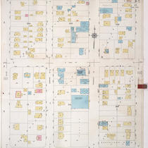
Title
-
Sanborn Map, Kansas City, Vol. 9, 1930-1957, Page p1013
-
Description
-
A portion of Kansas City from W. 73rd Street south to W. 75th Street and from Pennsylvania Avenue east to Wornall Road, showing buildings, streets, and additions. Large numbers at edges of page refer to page with adjoining area.
-
Date
-
1930/1957
-
Object Type
-
Map
-
-
Title
-
Sanborn Map, Kansas City, Vol. 9, 1930-1957, Page p1120
-
Description
-
A portion of Kansas City from E. 72nd Street south to E. 74th Street and from Olive Street east to Montgall Avenue, showing buildings, streets, and additions. Large numbers at edges of page refer to page with adjoining area.
-
Date
-
1930/1957
-
Object Type
-
Map
-
-
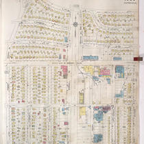
Title
-
Sanborn Map, Kansas City, Vol. 9, 1930-1957, Page p1008
-
Description
-
A portion of Kansas City from W. 70th Street south to W. 73rd Street and from Jefferson Street east to Baltimore Avenue, showing buildings, streets, and additions. Large numbers at edges of page refer to page with adjoining area. Country Club Lumber Company is noted on the map, but the 1939 city directory calls it the Snyder-Kunkel Lumber Company, 321 W. Gregory Blvd.
-
Date
-
1930/1957
-
Object Type
-
Map
-

-
Title
-
Sanborn Map, Kansas City, Vol. 9, 1930-1957, Page p1104
-
Description
-
A portion of Kansas City from E. 69th Street south to E. 70th Street Terrace and from Olive Street east to Montgall Avenue, showing buildings, streets, and additions. Large numbers at edges of page refer to page with adjoining area.
-
Date
-
1930/1957
-
Object Type
-
Map
-

-
Title
-
Sanborn Map, Kansas City, Vol. 9, 1930-1957, Page p1015
-
Description
-
A portion of Kansas City from W. 75th Street south to W. 76th Street and from Jefferson Street east to Wornall Road, showing buildings, streets, and additions. Large numbers at edges of page refer to page with adjoining area.
-
Date
-
1930/1957
-
Object Type
-
Map
-

-
Title
-
Sanborn Map, Kansas City, Vol. 9, 1930-1957, Page p1113
-
Description
-
A portion of Kansas City from E. 74th Street south to E. 77th Street and from Troost Avenue east to Wayne Avenue, showing buildings, streets, and additions. Large numbers at edges of page refer to page with adjoining area. At top of map, "Add'l Sheet, May 1937."
-
Date
-
1930/1957
-
Object Type
-
Map
