|
Sanborn Map, Kansas City, Vol. 9, 1930-1941, Page p0902 |
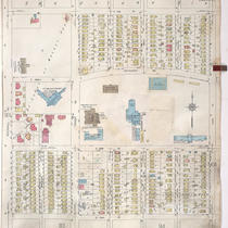 |
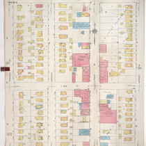
A portion of Kansas City from E. 51st Street south to E. 54th Street and from Rockhill Road east to Lydia Avenue, showing buildings, streets, and additions. Large numbers at edges of page refer to... |
|
Sanborn Map, Kansas City, Vol. 9, 1930-1957 |
 |
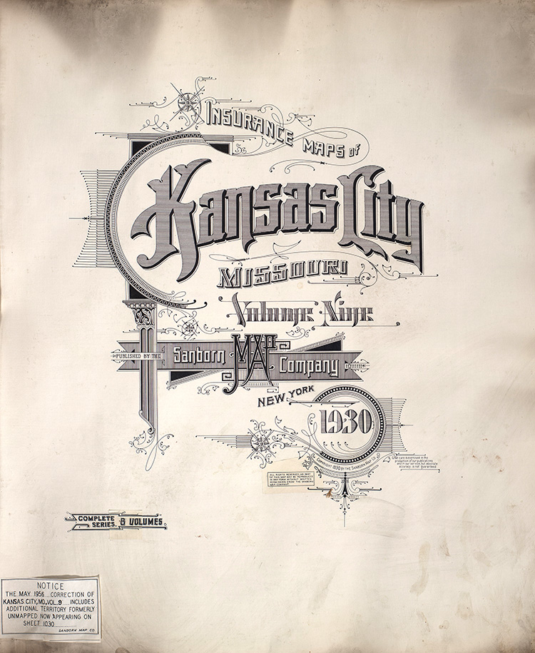
Insurance Maps of Kansas City, Missouri, Volume Nine, Published by the Sanborn Map Company, 1930 updated to 1957. |
|
Sanborn Map, Kansas City, Vol. 9, 1930-1957, Page f002 |
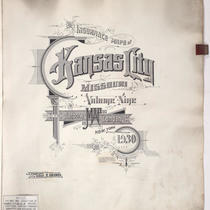 |
Title page of 1930 volume (updated to 1957) that reads, "Insurance Maps of Kansas City, Missouri, Volume Nine, Published by the Sanborn Map Company." |
|
Sanborn Map, Kansas City, Vol. 9, 1930-1957, Page f003 |
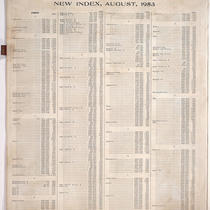 |
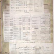
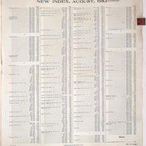
New Index, August 1953, showing streets, businesses, and the corresponding sheet number. |
|
Sanborn Map, Kansas City, Vol. 9, 1930-1957, Page f004 |
 |
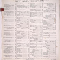
New Index - continued, August 1953, showing streets, businesses, and the corresponding sheet number. |
|
Sanborn Map, Kansas City, Vol. 9, 1930-1957, Page f005 |
 |
New Index - continued, August 1953, showing streets, businesses, and the corresponding sheet number. |
|
Sanborn Map, Kansas City, Vol. 9, 1930-1957, Page p0001 |
 |
Title page of 1930 volume (updated to 1957) that reads, "Insurance Maps of Kansas City, Missouri, Volume Nine, Published by the Sanborn Map Company." |
|
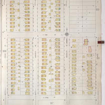
Sanborn Map, Kansas City, Vol. 9, 1930-1957, Page p0903 |
 |
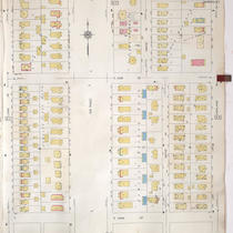
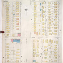
A portion of Kansas City from E. 51st Street south to E. 52nd Street and from Lydia Avenue east to Highland Avenue, showing buildings, streets, and additions. Large numbers at edges of page refer to... |
|
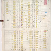
Sanborn Map, Kansas City, Vol. 9, 1930-1957, Page p0904 |
 |
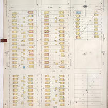
A portion of Kansas City from E. 53rd Street south to E. 54th Street and from Lydia Street east to Highland Avenue, showing buildings, streets, and additions. Large numbers at edges of page refer to... |
|
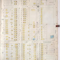
Sanborn Map, Kansas City, Vol. 9, 1930-1957, Page p0905 |
 |
A portion of Kansas City from E. 51st Street south to E. 52nd Street and from Highland Avenue east to Euclid Avenue, showing buildings, streets, and additions. Large numbers at edges of page refer to... |
|
Sanborn Map, Kansas City, Vol. 9, 1930-1957, Page p0906 |
 |
A portion of Kansas City from E.53rd Street south to E. 54th Street and from Highland Avenue east to Euclid Avenue, showing buildings, streets, and additions. Large numbers at edges of page refer to... |
|
Sanborn Map, Kansas City, Vol. 9, 1930-1957, Page p0907 |
 |
A portion of Kansas City from E. 51st Street south to E. 52nd Street and from Euclid Avenue east to Park Avenue, showing buildings, streets, and additions. Large numbers at edges of page refer to... |
|
Sanborn Map, Kansas City, Vol. 9, 1930-1957, Page p0908 |
 |
A portion of Kansas City from E. 53rd Street south to E. 54th Street and from Euclid Avenue east to Park Avenue, showing buildings, streets, and additions. Large numbers at edges of page refer to... |
|
Sanborn Map, Kansas City, Vol. 9, 1930-1957, Page p0909 |
 |
A portion of Kansas City from E. 51st Street south to E. 52nd Street and from Park Avenue east to Prospect Avenue, showing buildings, streets, and additions. Large numbers at edges of page refer to... |
|
Sanborn Map, Kansas City, Vol. 9, 1930-1957, Page p0910 |
 |
A portion of Kansas City from E. 53rd Street south to E. 54th Street and from Park Avenue east to Prospect Avenue, showing buildings, streets, and additions. Large numbers at edges of page refer to... |
|
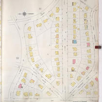
Sanborn Map, Kansas City, Vol. 9, 1930-1957, Page p0911 |
 |
A portion of Kansas City from E. 54th Street south to E. 55th Street and from Cherry Street east to Rockhill Road, showing buildings, streets, and additions. Large numbers at edges of page refer to... |
|
Sanborn Map, Kansas City, Vol. 9, 1930-1957, Page p0912 |
 |
A portion of Kansas City from E. 54th Street south to Crestwood Drive and from Oak Street east to Cherry Street, showing buildings, streets, and additions. Large numbers at edges of page refer to... |
|
Sanborn Map, Kansas City, Vol. 9, 1930-1957, Page p0913 |
 |
A portion of Kansas City from E. 54th Street south to E. 55th Street and from Rockhill Road east to Forest Avenue, showing buildings, streets, and additions. Large numbers at edges of page refer to... |
|
Sanborn Map, Kansas City, Vol. 9, 1930-1957, Page p0914 |
 |
A portion of Kansas City from E. 54th Street south to E. 55th Street and from Forest Avenue east to Lydia Avenue, showing buildings, streets, and additions. Large numbers at edges of page refer to... |
|
Sanborn Map, Kansas City, Vol. 9, 1930-1957, Page p0915 |
 |
A portion of Kansas City from E. 54th Street south to E. 55th Street and from Lydia Avenue east to Highland Avenue, showing buildings, streets, and additions. Large numbers at edges of page refer to... |